Today I put a 50% deposit down on a new size 52 Dahon Tournado. Dahon told my local bike shop that they should have it by mid-August, so we'll see if that holds. I've been waiting for this bike to be available since early spring. But I want it *now* damn it.
It's so pretty!
I did talk to my bike shop about switching in a different cassette. The Tournado comes with a 9 speed 11-26 cassette, which just doesn't provide the low gears that I'd like in a touring bike. If I get a different cassette, I'll also need to switch out the rear derailleur. The Shimano Ultegra derailleur will only work with a maximum of 27 teeth on the cassette, so if I want a 32 or 34 granny gear, I'll have to get a different derailleur.
Sunday, July 27, 2008
Monday, July 14, 2008
Death Ride pics
Most of these were taken with my cell phone, so the quality isn't that high. But it's enough to give you a little flavor for the ride.
 |
| Tahoe Death Ride |
Sunday, July 13, 2008
Death Ride Report (2 passes)
As late as Friday evening I wasn’t sure that I was even going to attempt the Death Ride, the event that I had been training for since, like, December. With all of the forest fires blazing in Northern California, the air quality in the Tahoe basin was terrible. When we arrived on Wednesday evening, there was actually ash raining down. Yuck. In nearby Reno, they were getting ready to declare a stage 2 air quality alert, which means that everyone is advised to stay indoors. So, in summary, not exactly the best conditions for an extreme endurance event. Even Cycling Boss was thinking about skipping the whole thing (or maybe just doing one or two passes at the most).
Check it out: last year when I was in Tahoe for a week, I took this shot from the bike path along the southern part of the lake. On Thursday while I was out riding I stopped in the same spot and took a shot of the lake. That’s how bad it was.
Anyway, I decided to go ahead and head out to Markleeville for the event on Saturday and just play it by ear. If it was too smoky to ride, I’d just turn around and head back. So Saturday morning I was up at 4:30, in the car by 5, and out near the ride start by 5:45. By some meteorological miracle, the air was relatively clear of smoke! I parked by the side of the road where lots of other riders were parking and unpacking their gear. I didn’t realize until later I was actually about 2 miles from the start at Turtle Rock park, and that there were plenty of spots along the road a bit closer. Oh well.
It was late enough (just after 6am) that I didn’t need my bike lights, but it was still chilly out. I had my vest and arm warmers, but going downhill into Markleeville (elevation 5500 feet), I briefly wished I had my leg warmers and full-finger gloves. Luckily I quickly warmed up and ended up shedding the vest and arms about a quarter of the way up Monitor.
Beginning the ascent up Monitor in the early daylight was really beautiful. The road was closed to auto traffic so it was just us cyclists. The road outside of Markleeville follows a nice alpine stream (Carson River, apparently) for a couple of miles before the turnoff for the pass. The first few miles of the climb are comfortably graded, and I thought, what a lovely way to spend the early morning, out here in the middle of the Sierras climbing away! Then it started to get steep. About a quarter of the way up there are patches of 9.2%, 9.5%, and 10.3% (according to the race elevation map). These steeper sections really slowed me down, and I felt like I was crawling up the mountain. I did manage to get some nice photos of this stretch, just using the ol’ cell phone. When I figure out how to get them out of the phone I’ll post them. It’s a very scenic ride, especially before the heat of the day kicks in. Monitor pass is an arid high desert landscape, with some amazing vistas of the surrounding sierras. I’m not that familiar with the geography, but I imagine we were able to see a good number of the high sierra peaks from this vantage point. After a couple of more moderate sections (7.3, 7.5%) I suddenly emerged at the summit rest stop where a volunteer placed my first pass sticker on my rider bib (elevation 8314 feet). It came up so suddenly that I didn’t think it was the summit at first. I was all, Wait, is this the top of Monitor? The volunteer looked at me like, Duh. I dunno, maybe it was the thin air. Anyway, I continued on just a half mile or so past the summit, because Cycling Boss had said that there was a nice view down the other side into Nevada. I rounded the base of a hill and sure enough, there was a nice vista of the Nevada side of Monitor. There were also hundreds of Death Ride cyclists climbing up the back side (pass 2). While I was taking a picture with my camera, one guy yelled out, "Call my mom! Tell her I need help!" Heh.
Back at the Monitor summit rest stop, I overheard a cyclist talking to the search and rescue helicopter pilot. I guess because it’s so remote, they have the helicopter available onsite in case they need to take someone off the hospital. The pilot was explaining all this and then added, "They don’t let us enter the race though. That wouldn’t be fair to the cyclists." Ah, everyone’s a comedian at high altitude!
My favorite part was the descent down Monitor, which is long (almost 10 miles) with good sight lines, good road surface, and very few technical turns. It was a BLAST going down this mountain at 40 mph.
Back down at the base of Monitor pass (at the 89 and 4 junction), we all headed south on 4 toward Ebbetts. The first couple miles of Ebbetts were nice and gentle, just meandering along the east fork of the Carson River. We had a quick rest stop that featured both a bag pipe player and a Hawaiian theme (shoutout?), and then shortly after the real climbing began. Ebbetts was… tough. There were a couple sections of 10% and at least one 12%, and the whole climb just seemed relentless. However it was absolutely gorgeous, much more wooded that Monitor pass, with great vistas from the ridge. It reminded me a lot of Yosemite. The last few miles I had to stop for quick beathers every 2 miles or so, just to get my heart rate down and my breathing leveled out. However I didn’t need to walk my bike at any point, which is saying something because there were a lot of folks walking up Ebbetts. It may be the most challenging climb I’ve ever done; it’s probably almost on my top 5 list of beautiful rides. And to be able to do it with the road closed to car traffic was pretty awesome. Anyway, I finally made it up to the summit at 12:45 pm, got my second sticker, and decided that there was no way I doing the third pass (down the backside of Ebbetts and back up). I was thinking that I could probably grind it out, but I didn’t think I could then make it back the remaining 12 miles to Turtle Rock. Ultimately I think this was the right decision, because the final little climb between Markleeville and my car almost did me in. If I had attempted the third pass, I would have had to get the helicopter to lift me back to my car.
So, all in all, a good ride and a decent result, although I really wanted to complete three passes. Next year, if I do it again, I’m sure I can do 3 and probably even 4 passes if I train just a little more. I’m also thinking about parking closer to Markleeville to avoid that last little hill that’s just no fun at all.
Next.. prep rides in Tahoe for the Death Ride
Total Distance: 62 miles, 2 passes (Monitor 1 and Ebbetts 1)
Total Elevation gain: 6238 feet
Time in the saddle: 7 hours
Elevation map: Death Ride elevation map
Rivendell sightings: one Atlantis
Check it out: last year when I was in Tahoe for a week, I took this shot from the bike path along the southern part of the lake. On Thursday while I was out riding I stopped in the same spot and took a shot of the lake. That’s how bad it was.
 |  | |
| July 2008 | July 2007 |
Anyway, I decided to go ahead and head out to Markleeville for the event on Saturday and just play it by ear. If it was too smoky to ride, I’d just turn around and head back. So Saturday morning I was up at 4:30, in the car by 5, and out near the ride start by 5:45. By some meteorological miracle, the air was relatively clear of smoke! I parked by the side of the road where lots of other riders were parking and unpacking their gear. I didn’t realize until later I was actually about 2 miles from the start at Turtle Rock park, and that there were plenty of spots along the road a bit closer. Oh well.
It was late enough (just after 6am) that I didn’t need my bike lights, but it was still chilly out. I had my vest and arm warmers, but going downhill into Markleeville (elevation 5500 feet), I briefly wished I had my leg warmers and full-finger gloves. Luckily I quickly warmed up and ended up shedding the vest and arms about a quarter of the way up Monitor.
Beginning the ascent up Monitor in the early daylight was really beautiful. The road was closed to auto traffic so it was just us cyclists. The road outside of Markleeville follows a nice alpine stream (Carson River, apparently) for a couple of miles before the turnoff for the pass. The first few miles of the climb are comfortably graded, and I thought, what a lovely way to spend the early morning, out here in the middle of the Sierras climbing away! Then it started to get steep. About a quarter of the way up there are patches of 9.2%, 9.5%, and 10.3% (according to the race elevation map). These steeper sections really slowed me down, and I felt like I was crawling up the mountain. I did manage to get some nice photos of this stretch, just using the ol’ cell phone. When I figure out how to get them out of the phone I’ll post them. It’s a very scenic ride, especially before the heat of the day kicks in. Monitor pass is an arid high desert landscape, with some amazing vistas of the surrounding sierras. I’m not that familiar with the geography, but I imagine we were able to see a good number of the high sierra peaks from this vantage point. After a couple of more moderate sections (7.3, 7.5%) I suddenly emerged at the summit rest stop where a volunteer placed my first pass sticker on my rider bib (elevation 8314 feet). It came up so suddenly that I didn’t think it was the summit at first. I was all, Wait, is this the top of Monitor? The volunteer looked at me like, Duh. I dunno, maybe it was the thin air. Anyway, I continued on just a half mile or so past the summit, because Cycling Boss had said that there was a nice view down the other side into Nevada. I rounded the base of a hill and sure enough, there was a nice vista of the Nevada side of Monitor. There were also hundreds of Death Ride cyclists climbing up the back side (pass 2). While I was taking a picture with my camera, one guy yelled out, "Call my mom! Tell her I need help!" Heh.
Back at the Monitor summit rest stop, I overheard a cyclist talking to the search and rescue helicopter pilot. I guess because it’s so remote, they have the helicopter available onsite in case they need to take someone off the hospital. The pilot was explaining all this and then added, "They don’t let us enter the race though. That wouldn’t be fair to the cyclists." Ah, everyone’s a comedian at high altitude!
My favorite part was the descent down Monitor, which is long (almost 10 miles) with good sight lines, good road surface, and very few technical turns. It was a BLAST going down this mountain at 40 mph.
Back down at the base of Monitor pass (at the 89 and 4 junction), we all headed south on 4 toward Ebbetts. The first couple miles of Ebbetts were nice and gentle, just meandering along the east fork of the Carson River. We had a quick rest stop that featured both a bag pipe player and a Hawaiian theme (shoutout?), and then shortly after the real climbing began. Ebbetts was… tough. There were a couple sections of 10% and at least one 12%, and the whole climb just seemed relentless. However it was absolutely gorgeous, much more wooded that Monitor pass, with great vistas from the ridge. It reminded me a lot of Yosemite. The last few miles I had to stop for quick beathers every 2 miles or so, just to get my heart rate down and my breathing leveled out. However I didn’t need to walk my bike at any point, which is saying something because there were a lot of folks walking up Ebbetts. It may be the most challenging climb I’ve ever done; it’s probably almost on my top 5 list of beautiful rides. And to be able to do it with the road closed to car traffic was pretty awesome. Anyway, I finally made it up to the summit at 12:45 pm, got my second sticker, and decided that there was no way I doing the third pass (down the backside of Ebbetts and back up). I was thinking that I could probably grind it out, but I didn’t think I could then make it back the remaining 12 miles to Turtle Rock. Ultimately I think this was the right decision, because the final little climb between Markleeville and my car almost did me in. If I had attempted the third pass, I would have had to get the helicopter to lift me back to my car.
So, all in all, a good ride and a decent result, although I really wanted to complete three passes. Next year, if I do it again, I’m sure I can do 3 and probably even 4 passes if I train just a little more. I’m also thinking about parking closer to Markleeville to avoid that last little hill that’s just no fun at all.
Next.. prep rides in Tahoe for the Death Ride
Total Distance: 62 miles, 2 passes (Monitor 1 and Ebbetts 1)
Total Elevation gain: 6238 feet
Time in the saddle: 7 hours
Elevation map: Death Ride elevation map
Rivendell sightings: one Atlantis
Tuesday, July 8, 2008
Adirondacks Day 3
On day 3 of the Adirondack tour, we decided to head up the 28N towards the town of Newcomb, advertised as the “heart of the Adirondacks”. I figured it was about 27 miles up to Newcomb, supposedly mostly uphill, so then we could turn around and cruise back downhill to North Creek. 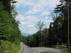 In fact, the first few miles out of North Creek were gradually uphill, then just outside the hamlet of Minerva (weird town, I don’t recommend it) is one steeper climb of about a mile or so. After that, we were back into rolling terrain. The landscape up in this area was a bit different than what we had experienced on the previous days. It felt more like what I associate with alpine lake regions, where the foliage is a bit more sparse and you see more pine trees. It just feels more like being in the mountains. Anyway, the 28N was a nice road… very little traffic and a wide shoulder.
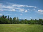 Once we got to Newcomb, we stopped briefly at a lovely picnic area with nice vistas of pretty much all the surrounding mountains. Really nice spot, and one of the best public restrooms I’ve ever seen! At this point it occurred to me that if my cycling buddies wanted to continue forward and do the full loop back to North Creek (about 80 miles) they could do that and I could just cruise back on the 28N. I could tell J was dying to do the full loop, and indeed both R and J ended up riding the reverse “Teddy’s Trail” loop. I don’t think J would have been able to face our innkeeper the next morning if he hadn’t done the full 80 mile ride. For my part, I was more worried about bruising my cycling ass than my cycling pride, so I was more than happy to return back the way I came.
 But before parting ways for the day, we continued on into the “town” of Newcomb and stopped at a very strange general store run by, judging by appearances, some siblings or cousins who had married and bred. I don’t mean to sound like a city snob, and all the folks in our little North Creek hamlet were terrific, but the people at this store in Newcomb were weird. I don’t think any of us even considered eating at their “diner” but instead just grabbed some snacks and hit the road. Wow. Oh, we also passed what was billed as the “source of the Hudson River”, which was pretty cool.
Heading back down the 28N to North Creek was actually a fair amount of work. I knew that once I hit the steep hill (now a descent) prior to Minerva, it would be pretty much downhill the whole way. But the 15 miles or so between Newcomb and Minerva were rolling terrain, with quite a few ascents. At this point, during the heat of the day, in my granny gear climbing up the hills, I started attracting some of my insect friends trying to tag along for the ride. I actually had two flies bite me through my cycling gloves, which is pretty fucking ballsy. Unfortunately for them, I carry repellant, and am mighty liberal with the deet. After a quick dousing, my flying friends stayed away for the rest of the ride. Woohoo!
Arriving back in North Creek around 4pm, I didn’t expect R and J to return before 6 at the earliest, so I figured it was a good opportunity to do some souvenir shopping. Heading over to the North Creek Deli and Marketplace, a little bluegrass band was set up out front playing Woody Guthrie songs to a small group of folks. Our innkeeper had told us about this group, and had mentioned that the lead singer was transitioning (check) and that they had an older gentleman playing spoons (check). There’s nothing like being in a tiny little town out in the middle of nowhere with a bluegrass band standing in front of an old general store singing This Land is Your Land. Actually, the only thing that would be more appropriate would be if they sang some Pete Seeger. Yeah.
Anyhoodle, my peeps ended up getting back from their full 80 mile loop by 5:30. That’s hard core. Mad props to those guys for kicking some serious cycling ass in the Adirondacks.
More later on the local flavor…
In fact, the first few miles out of North Creek were gradually uphill, then just outside the hamlet of Minerva (weird town, I don’t recommend it) is one steeper climb of about a mile or so. After that, we were back into rolling terrain. The landscape up in this area was a bit different than what we had experienced on the previous days. It felt more like what I associate with alpine lake regions, where the foliage is a bit more sparse and you see more pine trees. It just feels more like being in the mountains. Anyway, the 28N was a nice road… very little traffic and a wide shoulder. Once we got to Newcomb, we stopped briefly at a lovely picnic area with nice vistas of pretty much all the surrounding mountains. Really nice spot, and one of the best public restrooms I’ve ever seen! At this point it occurred to me that if my cycling buddies wanted to continue forward and do the full loop back to North Creek (about 80 miles) they could do that and I could just cruise back on the 28N. I could tell J was dying to do the full loop, and indeed both R and J ended up riding the reverse “Teddy’s Trail” loop. I don’t think J would have been able to face our innkeeper the next morning if he hadn’t done the full 80 mile ride. For my part, I was more worried about bruising my cycling ass than my cycling pride, so I was more than happy to return back the way I came. But before parting ways for the day, we continued on into the “town” of Newcomb and stopped at a very strange general store run by, judging by appearances, some siblings or cousins who had married and bred. I don’t mean to sound like a city snob, and all the folks in our little North Creek hamlet were terrific, but the people at this store in Newcomb were weird. I don’t think any of us even considered eating at their “diner” but instead just grabbed some snacks and hit the road. Wow. Oh, we also passed what was billed as the “source of the Hudson River”, which was pretty cool. Heading back down the 28N to North Creek was actually a fair amount of work. I knew that once I hit the steep hill (now a descent) prior to Minerva, it would be pretty much downhill the whole way. But the 15 miles or so between Newcomb and Minerva were rolling terrain, with quite a few ascents. At this point, during the heat of the day, in my granny gear climbing up the hills, I started attracting some of my insect friends trying to tag along for the ride. I actually had two flies bite me through my cycling gloves, which is pretty fucking ballsy. Unfortunately for them, I carry repellant, and am mighty liberal with the deet. After a quick dousing, my flying friends stayed away for the rest of the ride. Woohoo!
Arriving back in North Creek around 4pm, I didn’t expect R and J to return before 6 at the earliest, so I figured it was a good opportunity to do some souvenir shopping. Heading over to the North Creek Deli and Marketplace, a little bluegrass band was set up out front playing Woody Guthrie songs to a small group of folks. Our innkeeper had told us about this group, and had mentioned that the lead singer was transitioning (check) and that they had an older gentleman playing spoons (check). There’s nothing like being in a tiny little town out in the middle of nowhere with a bluegrass band standing in front of an old general store singing This Land is Your Land. Actually, the only thing that would be more appropriate would be if they sang some Pete Seeger. Yeah.
Anyhoodle, my peeps ended up getting back from their full 80 mile loop by 5:30. That’s hard core. Mad props to those guys for kicking some serious cycling ass in the Adirondacks.
More later on the local flavor…
Monday, July 7, 2008
Adirondacks Tour (3 days, 150 miles)
 Yesterday I returned from a wonderful bicycling tour in the Gore Mountain region of the southern Adirondacks. This was my first trip to this beautiful part of upstate New York, and it proved to be an ideal location for cycling. We arrived at base camp (Goose Pond Inn B&B in North Creek) late on Wednesday night and didn’t even bother to unpack our gear before crashing out for the night. I guess we were all a little beat, because we all slept right through breakfast the next morning, served promptly between zero-eight-hundred and zero-nine-hundred hours. I guess when they say bed and breakfast, they mean it. After that initial faux pas, we fell in line with the regime and got on famously with the innkeepers. Seriously though, it’s a great B&B in a great location with clean rooms and a very nice breakfast each morning. For a very affordable price. Thumbs up from the rambler. If you visit, tell ‘em Miss California sent you.
The Machine: On this trip J was kind enough to loan me his Rivendell Saluki, undoubtedly the most valuable bicycle I’ve ever had the pleasure to ride on a multi-day tour. It struck me as I was describing the bike to Crazy Cycling Boss that the setup on this thing is pretty unusual, at least from the perspective of folks riding aluminum and carbon. The Rivendell (“Jean-Pierre”) is an old-school steel frame touring bike that features a mustache handlebar with bar end friction shifters, fat 650 tires, and a newish Brooks saddle that I had a hand (so to speak) in breaking in over the course of the trip. I had a bit of trouble with the saddle at the end of each day, but all in all a very classy ride.
The Routes:
Day 1: The Lakes of Chester About 38 miles and 2600 feet of climbing.
Our first day out we all wanted to do a relatively easy ride to get a feel for the terrain, so we decided on the “lakes of Chester” loop, which goes north through Olmsteadville, over through Pottersville, past Loon Lake and Friends Lake, then back up to North Creek. Although it rained a bit this day, it was a nice introduction to the region, which is marked by small quaint hamlets (general store, church, cemetery), small lakes, and green forest. In some ways it reminded me of upper Michigan where I had visited as a wee one.
Day 2: North Creek-Schroon Lake 55 miles, 3800 feet of climbing.
We had talked about doing a couple of the longer routes outlined in the touring book, but after a day on the road I didn’t feel like I could do 80 miles with my ass in Jean-Pierre’s saddle.
 So we managed to piece together two other routes into a nice 55 miler out to Schroon Lake and back. The weather on this second day (July 4th) was pretty much perfect: warm, sunny, bright blue sky, very low humidity. We started out through quiet backroads to arrive at the southern end of Schroon Lake. This is one of those quintessential lake resort towns that are probably overrun with tourists most of the year, and yet you can’t really resist its charm. We stopped in the downtown area for a quick rest and a snack, and were lucky enough to catch some of the 4th of July entertainment, which consisted of a terrible choir performing in a very picturesque waterfront gazebo. Continuing north we rounded the lake and returned to quiet country roads. This portion of the route was really beautiful, and took us through marshlands and forest, with occasional views of the lake. The only downside here was the introduction of bugs and my “shock and awe” deet-based response. I hate using chemicals, but I hate bugs even more, so there you go.
 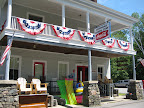 Along the eastern shore of the lake, we stopped by the general store in the town of Adirondack. It seemed like a bit of a zoo inside, so we only stocked up on minimal supplies before hitting the road again. Once we completed the loop around Schroon Lake, it was a relatively quick ride down route 9, to route 8, then to route 28 back to North Creek. A really lovely ride.
Next.. day 3 and local Adirondack flavor.
Subscribe to:
Posts (Atom)
