Coming out of Trader Joe's today, a couple of guys were admiring Artemis, my Dahon Tournado. They asked if it was mine, I said yes, and then one of them asked if I had a blog. Hey! Now I suppose it's possible that there are other people out there blogging about their Dahons, but I'm going to go ahead and claim a new reader all the same. This brings my total readership up to 5, a 25% increase over this time last year.
I think this is a clear mandate to keep blogging. Unfortunately with the weather turning cold and probably rainy, I don't think a ride up Diablo is looking likely tomorrow. It might have to be an indoor trainer day.
Saturday, December 13, 2008

Sunday, October 5, 2008
Harvest ride (about 55 miles)
This weekend I went up to the Ukiah area for the Harvest Ride, which begins and ends at Fetzer winery in Hopland and goes around the wine-growing valley region at the southern end of Mendocino county. On the way up, I stopped in the Calistoga area to pick up wine orders at Rutherford, Cuvaison, and Vincent Arroyo. No time to do any tasting this trip, since I wanted to get up to Ukiah before dark.
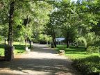 Originally I had made a reservation at a budget motel in Ukiah, but then my friends recommended Vichy Springs Resort. It was about the same price, and I’m so glad I switched lodging. Vichy Springs is a modest renovated traditional style motel, with a couple of separate one-story buildings each with several small rooms. The room was simple was nicely decorated, but the main theme here is the hot springs, which are naturally carbonated. They have one largish hot tub with the special water, and then several individual tubs that you can fill up self-serve style. I tried one of these first but found the water too cool (they say it’s at around 90 degrees) so then ended up soaking in the large hot tub. Nice.
For dinner, went into downtown Ukiah, which was nothing to write home about, but had dinner at the Ukiah Brewing Company. The place has great California country ambiance, features organic ingredients, and offers several brews on tap.
Oh, another nice thing about Vichy Springs Resort is that they offer a really nice continental breakfast starting at 7:30. That ended up being perfect timing for a pre-ride breakfast.
It only took about 15 minutes to drive from Vichy to the starting point of the ride, at the Fetzer bottling facility in Hopland. While registering, I overheard one of the organizers say that only 250 or 300 riders had signed up this year, which I think makes this the smallest organized event I’ve ever done. It was nice at first, because there weren’t hordes of cyclists on the road, but it also meant that the ride wasn’t as well supported as others I’ve done. They had some snafus with the cue sheets and route signage. I had a complete double-sided route sheet, but others only had one side, and some folks apparently had a map stapled to theirs (I didn’t have a map at all). So lots of people were somewhat lost to begin with. Then there was at least one error on the cue sheet, where it listed a left turn instead of a right (hello!), and then they failed to mark a turn down a country road that had no road sign. So.. several dozen of us missed a turn and end up at the wrong rest stop, having cut out a 12-15 mile loop. Hence the not-quite-metric-goodness of the total distance for this event.
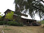 However, at the end of the ride, they had a fabulous barbecue back at the Fetzer winery. Maybe the best post-ride setup I’ve seen, although most conversations at the tables were about how the cue sheets and signs were totally screwed up.
Not sure if I’ll do this one again, but I would like to explore the area a bit more and spend some more time at Vichy Springs.
Bike vanity note: Got several compliments on the Tournado (Artemis?) Everyone agrees it is a very pretty bicycle.
Event begin and end: 8:40 am – 2:15pm
Total Distance: maybe 55 miles
Elevation gain: probably 2000 feet
Time in the Saddle: unknown
Originally I had made a reservation at a budget motel in Ukiah, but then my friends recommended Vichy Springs Resort. It was about the same price, and I’m so glad I switched lodging. Vichy Springs is a modest renovated traditional style motel, with a couple of separate one-story buildings each with several small rooms. The room was simple was nicely decorated, but the main theme here is the hot springs, which are naturally carbonated. They have one largish hot tub with the special water, and then several individual tubs that you can fill up self-serve style. I tried one of these first but found the water too cool (they say it’s at around 90 degrees) so then ended up soaking in the large hot tub. Nice.For dinner, went into downtown Ukiah, which was nothing to write home about, but had dinner at the Ukiah Brewing Company. The place has great California country ambiance, features organic ingredients, and offers several brews on tap.
Oh, another nice thing about Vichy Springs Resort is that they offer a really nice continental breakfast starting at 7:30. That ended up being perfect timing for a pre-ride breakfast.
It only took about 15 minutes to drive from Vichy to the starting point of the ride, at the Fetzer bottling facility in Hopland. While registering, I overheard one of the organizers say that only 250 or 300 riders had signed up this year, which I think makes this the smallest organized event I’ve ever done. It was nice at first, because there weren’t hordes of cyclists on the road, but it also meant that the ride wasn’t as well supported as others I’ve done. They had some snafus with the cue sheets and route signage. I had a complete double-sided route sheet, but others only had one side, and some folks apparently had a map stapled to theirs (I didn’t have a map at all). So lots of people were somewhat lost to begin with. Then there was at least one error on the cue sheet, where it listed a left turn instead of a right (hello!), and then they failed to mark a turn down a country road that had no road sign. So.. several dozen of us missed a turn and end up at the wrong rest stop, having cut out a 12-15 mile loop. Hence the not-quite-metric-goodness of the total distance for this event.
However, at the end of the ride, they had a fabulous barbecue back at the Fetzer winery. Maybe the best post-ride setup I’ve seen, although most conversations at the tables were about how the cue sheets and signs were totally screwed up. Not sure if I’ll do this one again, but I would like to explore the area a bit more and spend some more time at Vichy Springs.
Bike vanity note: Got several compliments on the Tournado (Artemis?) Everyone agrees it is a very pretty bicycle.
Event begin and end: 8:40 am – 2:15pm
Total Distance: maybe 55 miles
Elevation gain: probably 2000 feet
Time in the Saddle: unknown
Tuesday, September 16, 2008
Tournado is in
Well the Tournado finally arrived last week. I made a couple visits to the bike shop, as the guys were assembling it, and had a couple of components swapped out (the seatpost with pump, the cassette, and the derailleur). And now, at long last, it's finally home. It's a beauty...
My one disappointment so far has been that the lovely new rack that I had ordered from Rivendell doesn't seem to fit. Argh. I'll have to go out to Walnut Creek and talk to those guys to figure out what the deal is.
 |
| From tournado |
My one disappointment so far has been that the lovely new rack that I had ordered from Rivendell doesn't seem to fit. Argh. I'll have to go out to Walnut Creek and talk to those guys to figure out what the deal is.
Sunday, August 31, 2008
August mileage stats and Dahon update
August was a pretty good month, thanks mostly to the Bike Against the Odds ride on the 23rd. I missed one weekend of riding which accounts for the slightly lower total mileage.
In other news, my Dahon Tournado has still not arrived, but the bike shop expects it to arrive in their Tuesday shipment. Whee!
Total mileage for August: 333
Hours in the saddle: 29.7 hours
Total climbing: 18,500 feet
In other news, my Dahon Tournado has still not arrived, but the bike shop expects it to arrive in their Tuesday shipment. Whee!
Total mileage for August: 333
Hours in the saddle: 29.7 hours
Total climbing: 18,500 feet
Mt Tam loop (47 miles)
Yesterday pmk and I did the Mt Tam loop, starting and finishing in Sausalito. Weather was pretty close to perfect: cool and overcast in the morning, with the sun breaking through by 10 so that we had some nice views along the ridge line and from the peak.
The climb up from Alpine Dam Bridge to Ridgecrest was a bit easier this time than last, although I was still creeping along at just under 4 mph. And the rollers along Ridgecrest are still a pain (it always seems like they’ll never end), but the views almost make up for it.
 Up at the Tam visitors’ center, they’re doing a bunch of construction and walkway improvement, so the main area is a bit of a mess. The concession stand vendor said that they’re using labor from the Sonoma county correctional facilities, and that they only do work on the weekends. So I guess that may take a while to complete.
After the ride, we had lunch in downtown Mill Valley at a place called Small Shed Flatbreads, where the flatbreads feature local organic ingredients. Tasty! Then back to Sausalito for mojitos, cfg-style, and a post-ride dinner courtesy of pmk: salmon with roasted potatoes and brussel sprouts. Good stuff.
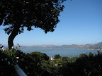
For the past few weeks pmk has been staying at this house up in the hills above Sausalito. The house belongs to the parents of the girlfriend of one of his employees, or some such thing. Everything about this house is pretty much perfect, and the views from the back patio are spectacular. Check it out:
Total Distance: 47 miles
Animules: lots of deer
Elevation gain: 4000 feet
Time in the Saddle: 5 hours
Update: pmk's garmin data shows a total elevation gain of 6400 feet, way more than what I estimated from my KLIMB software.
The climb up from Alpine Dam Bridge to Ridgecrest was a bit easier this time than last, although I was still creeping along at just under 4 mph. And the rollers along Ridgecrest are still a pain (it always seems like they’ll never end), but the views almost make up for it.
Up at the Tam visitors’ center, they’re doing a bunch of construction and walkway improvement, so the main area is a bit of a mess. The concession stand vendor said that they’re using labor from the Sonoma county correctional facilities, and that they only do work on the weekends. So I guess that may take a while to complete.After the ride, we had lunch in downtown Mill Valley at a place called Small Shed Flatbreads, where the flatbreads feature local organic ingredients. Tasty! Then back to Sausalito for mojitos, cfg-style, and a post-ride dinner courtesy of pmk: salmon with roasted potatoes and brussel sprouts. Good stuff.
For the past few weeks pmk has been staying at this house up in the hills above Sausalito. The house belongs to the parents of the girlfriend of one of his employees, or some such thing. Everything about this house is pretty much perfect, and the views from the back patio are spectacular. Check it out:
Total Distance: 47 miles
Animules: lots of deer
Elevation gain: 4000 feet
Time in the Saddle: 5 hours
Update: pmk's garmin data shows a total elevation gain of 6400 feet, way more than what I estimated from my KLIMB software.
Tuesday, August 26, 2008
Harvest Ride century
Next big event coming up: the Harvest Ride in Hopland (Mendocino County) the first weekend in October. I've signed up to do the full century, but have no idea what the route profile looks like. Mysterious!
Sunday, August 24, 2008
Bike Against the Odds (70 mile route)
This Saturday was the Bike Against the Odds charity ride, to benefit the Breast Cancer Fund. I reached my goal of raising $1000 in donations; thanks guys! Here's the official cfg ride report.
I began my Saturday morning by missing the BART train that I had wanted to take from my house to downtown Oakland. Not wanting to wait 20 minutes for the next train, I decided to go ahead and ride down to Lake Merritt. I took my usual commuting route so it felt almost like I was riding into work. On a Saturday. Yay! Anyway, I arrived at the lake, got checked in, and was on the road by 7:30. The weather was overcast and on the cool side, but that was fine with me. I had been hoping for nice cool weather for this ride. The east side of the Oakland hills can really heat up this time of year, and I was hoping to avoid climbing "the bears" in 90 degree heat.
First climb of the morning was up Old Tunnel Road to Skyline. This is my usual route into the Oakland hills, so it was a piece of cake. Up on Skyline (elevation about 1400 ft), the fog was hugging the hills and visibility was very low. Once I started zipping along the Skyline ridge (past first rest stop at Sibley park), I briefly wished I had brought some of my winter gear along. It was cold, people.
From Skyline, the route took us up and over the Oakland hills into Moraga, then a few miles north to Orinda. For the local cyclists: Skyline > Redwood > up Pinehurst > Canyon > Moraga Way. I arrived at the next rest stop, at the intersection of Bear Creek and San Pablo Dam Road, at 10:15am. At this point the folks doing the 50 mile option turned up Wildcat Canyon to climb back into the Oakland/Berkeley Hills. I was doing the extra loop around the reservoirs, so I continued straight down San Pablo Dam Road.
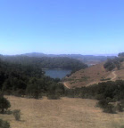 The loop around the San Pablo and Briones Reservoirs is a popular cycling route and is often referred to as "the three bears loop", because there are (at least) three main hills to climb on Bear Creek Road. I usually ride this loop counterclockwise, so this was a little different hitting the climbs in the opposite direction. There were very few cyclists out on the road at this point in the ride. Maybe most riders did the shorter 50 mile option. Losers! At any rate, I was back at the intersection of San Pablo Dam and Bear Creek a little after noon for more snacks and a water refill. At this point I had done about 50 miles and still felt strong.
The route then crossed San Pablo Dam for a climb up Wildcat Canyon to Inspiration Point. I figured this would be the toughest climb of the day for me, being a bit steeper and coming 50 miles into the ride. Luckily the temperature was still comfortable and the road is relatively shaded, so I made it up that climb without any problems. Then I quickly zipped through Tilden to the other side of the hills, overlooking Berkeley. Then it was up Grizzly Peak for the last climb of the day. At this point fatigue was starting to set in, but fortunately Grizzly Peak is a relatively gentle climb. And I knew that once I got to the top, it was going to be all downhill for the last 12 miles back to Lake Merritt. There was one cyclist on this final climb, let's call her "Anna", who had a bit of hard time and came very close to climbing in the SAG car about 1/4 mile shy of the top of the hill. She held on though and made it to the water stop at the top where her Team in Training cohorts were waiting to cheer her on. Good job Anna!
From the top of Grizzly, route back was Skyline > Shepard Canyon > Snake > Mountain > Park, etc. I pulled into the start/finish point just before 3pm. Pretty good ride!
Total distance: 74 miles
Total time in the saddle: 6.5 hours
Total elevation: 6000 feet
Animules: one deer and one wild turkey along Bear Creek Road
I began my Saturday morning by missing the BART train that I had wanted to take from my house to downtown Oakland. Not wanting to wait 20 minutes for the next train, I decided to go ahead and ride down to Lake Merritt. I took my usual commuting route so it felt almost like I was riding into work. On a Saturday. Yay! Anyway, I arrived at the lake, got checked in, and was on the road by 7:30. The weather was overcast and on the cool side, but that was fine with me. I had been hoping for nice cool weather for this ride. The east side of the Oakland hills can really heat up this time of year, and I was hoping to avoid climbing "the bears" in 90 degree heat.
First climb of the morning was up Old Tunnel Road to Skyline. This is my usual route into the Oakland hills, so it was a piece of cake. Up on Skyline (elevation about 1400 ft), the fog was hugging the hills and visibility was very low. Once I started zipping along the Skyline ridge (past first rest stop at Sibley park), I briefly wished I had brought some of my winter gear along. It was cold, people.
From Skyline, the route took us up and over the Oakland hills into Moraga, then a few miles north to Orinda. For the local cyclists: Skyline > Redwood > up Pinehurst > Canyon > Moraga Way. I arrived at the next rest stop, at the intersection of Bear Creek and San Pablo Dam Road, at 10:15am. At this point the folks doing the 50 mile option turned up Wildcat Canyon to climb back into the Oakland/Berkeley Hills. I was doing the extra loop around the reservoirs, so I continued straight down San Pablo Dam Road.
The loop around the San Pablo and Briones Reservoirs is a popular cycling route and is often referred to as "the three bears loop", because there are (at least) three main hills to climb on Bear Creek Road. I usually ride this loop counterclockwise, so this was a little different hitting the climbs in the opposite direction. There were very few cyclists out on the road at this point in the ride. Maybe most riders did the shorter 50 mile option. Losers! At any rate, I was back at the intersection of San Pablo Dam and Bear Creek a little after noon for more snacks and a water refill. At this point I had done about 50 miles and still felt strong. The route then crossed San Pablo Dam for a climb up Wildcat Canyon to Inspiration Point. I figured this would be the toughest climb of the day for me, being a bit steeper and coming 50 miles into the ride. Luckily the temperature was still comfortable and the road is relatively shaded, so I made it up that climb without any problems. Then I quickly zipped through Tilden to the other side of the hills, overlooking Berkeley. Then it was up Grizzly Peak for the last climb of the day. At this point fatigue was starting to set in, but fortunately Grizzly Peak is a relatively gentle climb. And I knew that once I got to the top, it was going to be all downhill for the last 12 miles back to Lake Merritt. There was one cyclist on this final climb, let's call her "Anna", who had a bit of hard time and came very close to climbing in the SAG car about 1/4 mile shy of the top of the hill. She held on though and made it to the water stop at the top where her Team in Training cohorts were waiting to cheer her on. Good job Anna!
From the top of Grizzly, route back was Skyline > Shepard Canyon > Snake > Mountain > Park, etc. I pulled into the start/finish point just before 3pm. Pretty good ride!
Total distance: 74 miles
Total time in the saddle: 6.5 hours
Total elevation: 6000 feet
Animules: one deer and one wild turkey along Bear Creek Road
Subscribe to:
Posts (Atom)
