Sunday, October 18, 2009

Bear Mountain to Manhattan

Friday morning, after a great night's sleep, I woke up to the sun shining! While taking advantage of the contintental breakfast in the lodge, I realized that everyone besides me in the common room was a West Point grad; I presume they were having a reunion because there were conversations going on around me concerning graduate years, class of whatever, etc. I hadn't realized that West Point was just up the road from here until R had pointed it out across the river the previous day. At any rate, this early morning sunshine was about all we got this last day on the road; there was another thunderstorm rolling in, and it was clouding over by the time we left Bear Mountain for Manhattan.

Just south of Bear Mountain, the route 9 bike signs direct you off the highway (we were on 9W at this point) to a dirt path. We went about 50 feet on it and quickly determined it wasn't passable with our tires. And I have 700x38s. It's dirt and chunky gravel, not very well maintained. So if you're in that area I would recommend staying on the highway.


This last 50 miles of route 9 are a bit hillier than the previous stretches we had been on, but it wasn't that bad. A couple of short climbs and several rollers. At Haverstraw we avoided some of the town congestion by following the signs down to the waterfront, although once the route rejoined the town center we managed to get turned around, just briefly. At one point the route 9 bicycle sign clearly pointed left, but we figured soon enough that we really needed to go right. Good times.

Our half-way point was Nyack, a really charming town right along the west bank of the Hudson River. Past Nyack we came to Piermont, where we stopped for lunch. At this point we were only about 12 miles from the George Washington Bridge, and stopped for a leisurely lunch at a little French bistro called Sidewalk Bistro. The French owner noticed our bikes and invited us to park them in the back garden area, which was very nice. I enjoyed a croque monsieur and a beer for lunch. Fabulous! During lunch we chatted with a fellow bicyclist, also with a loaded touring bike. He was from Montreal and heading down to Brooklyn. We wished him well and then hit the road for the final few miles back to Manhattan.

This portion of the route was gently hilly but mostly very comfortable terrain. Obviously Rachael knows this route well, so she led us through the final twists and turns to reach the south side of the George Washington Bridge, only to find it closed! So then we had to use the north side of the bridge, which involves going up and down about six flights of stairs, which I can tell you is not any fun with a loaded touring bike. Just getting up and down these stairs took us about 20 minutes. Once that little adventure was over, we were just cruising home along the Hudson River greenway. After not too long we saw our Montreal friend sitting on a park bench with a map, trying to figure out how to get to Brooklyn from this point. (I was surprised he had managed to get to the GW bridge and across). Rachael being a kind and generous soul offered to escort Jacques down to the Brooklyn bridge. I headed back to the apartment to begin celebrating the completion of the tour: 308 miles in the saddle!

The real celebration was later that evening, when we headed over to wd-50 for a fabulous dinner. I had the hanger tartare, the wagyu skirt steak, and about 17 desserts. Excellent end to the tour.
Wednesday, October 14, 2009

Mills Norrie to Bear Mountain (50 miles)

On Thursday morning we left Mills Norrie relatively early. It was cold in the morning, probably in the low 40s, and misting as we left our cabin in the park and rejoined state route 9 to head toward our next destination, Bear Mountain. After just a few miles on the road we passed through Hyde Park and stopped off to see the Vanderbilt mansion. I understand that this was one of their smaller mansions, probably the equivalent of a rustic cottage for them. I scooted around back to catch a view from their terrace, looking down the Hudson River valley. Lovely spot!


Further down the road in Hyde Park we pulled off the road briefly to see FDR’s childhood home. I don’t think we went far enough into the compound to see his house (we stopped at a house in the front of the estate) but it was still cool to stop at FDR’s home. Past Hyde Park we passed through Poughkeepsie, which was interesting because the scenery went sort of like:

Sprawl > blue collar urban > expensive > middle class

Just in the course of a mile or two. But it definitely seemed like a real working town, not just a quaint tourist destination like some of the smaller villages we had passed through. Next we passed through the little town of Wappingers Falls, and it was at this point that we briefly lost track of the route 9 markers. The state 9 bicycle route is fairly well marked… until it isn’t. Or until the signs tell you to turn right instead of turning left, for instance. In Wappingers Falls we perhaps made a wrong turn, or perhaps not. At any rate, thanks to our maps we knew in general where we needed to be, so we were able to rejoin the route quickly. Unfortunately it was at this point that the official route joined up with a highway/freeway, so we found ourselves on the shoulder of a pretty busy road for about 5 miles before rolling into Fishkill. Fortunately, in Fishkill we found a great little lunch spot where we could relax, warm up, and get away from the highway traffic for a bit. It was a little place called Pamela’s Java Hut. Those who know me know how much I love a tiki island theme, so this was right up my alley. Also, it was warm and they were serving chili that day, so, Score!


Past Fishkill, route 9 took us off of the highway (thanks Albany!) and back to more infrequently-trafficked roads. About 10 more miles took us to Cold Spring, a really nice little village back on the river front. In Cold Spring we stopped to get food supplies at a local diner and bakery. Rachael has some interesting stories about that place… maybe she’ll share some of them (hint hint). While in Cold Spring the locals (or local Harley riders) seemed to think that the dark clouds were going to open up in a full downpour at any moment, so we were a bit motivated to hurry on towards Bear Mountain without too much delay.

It was also at this point that we decided to call Bear Mtn to ask if there were food stuffes in the immediate area because we weren’t sure whether to buy dinner at Cold Spring or wait until later. The Bear Mtn folks advised Rachael that we were being upgraded from our reserved lodgings (in the rustic stone cottages) to the Overlook Lodge. Another score!

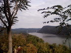
From Cold Spring we just had about 8 miles to go to get to Bear Mtn, but we were riding at a decent pace to try to beat the rain. Just before Bear Mtn we crossed over the bridge to the west side of the river, and took a few moments to appreciate the river that we had been travelling alongside for so many miles on the trip.


Just on the other side of the river we arrived at Bear Mountain. On way up the road to the Overlook we passed by the stone cottages, which looked pretty nice really. These cottages were built in 1935 as a WPA public works project. Rachael had thought the ride up to the Overlook was going to be a lot worse than it was, so she kept trying to manage my expectations for the climb (like, we could still stay at the cottages if you want! They’re right here!) But in fact it wasn’t that far up the hill to get the Overlook, which was super nice but still under renovation. It seemed like we were the first guests to stay in our newly renovated rooms; even so it felt incredibly luxurious to stay in brand new rooms with new beds and marble bathrooms. It was a big step up from the comfort station at the Mills Norrie State Park. Even the promise of their modest continental breakfast in the morning sent us into raptures. Breakfast! Brewed coffee!!

So after a long day in the saddle, we were all checked in and decided to take it easy by… going for a long walk around the lake. There’s a nice path that goes all around the lake, and then we forged our own path up the hill, through the brush, back up to the Overlook. Along the way we popped our heads into one of the stone cottages; it looked nice. Strangely at the front desk of the Overlook I had overheard a guest complaining about the cottages smelling of smoke, and the woman at the front desk had said something like, "Yeah they do smell like smoke". Sure enough the one we walked into did smell of smoke, and the fire alarm was buzzing, so they must have had some kind of incident. That may have accounted for our mysterious upgrade to the lodge. At any rate, the accommodations were great and the good night’s sleep was much needed as we prepared for our last day on the road, heading back into Manhattan.

Sunday, October 11, 2009

Days 4/5: Mills-Norrie and Dutchess County

Tuesday morning we left our cottage at Lake Taghkanic to ride south to our next destination: Mills-Norrie State Park in Dutchess county. From Taghkanic we headed west to pick up state route 9 in the town of Livingston.

New York route 9 is a designated bike route that follows the highway for the most part (diverging from it at certain points) all the way from the George Washington Bridge in NYC to the Canadian border to the north. On this day we were travelling about 30 miles down route 9 to get to our next destination, and it was an easy day on the road, even carrying all of our gear in our panniers. This section of the route is very flat and we were able to get into a nice rhythm on the bikes. I think the most interesting part of this route is the historic towns that one passes through along the Hudson, beginning with Livingston where we joined route 9.

I’ve been reading a book on the history of the Hudson, and Livingston Manor figures prominently in the early English history of the Hudson river valley, in the 17th century, after the Dutch rule had waned. The original land grant that formed Livingston Manor covered 160,000 acres in Columbia and Dutchess counties. Further down the road, route 9 passes through Clermont, another artifact of the original Livingston Manor. Clermont Manor had been established in 1728 by Robert Livingston, one of the descendants of the elder Livingston. It’s hard to keep track of all these Livingstons, since they’re all named Robert. Some of them are even named Robert Robert. Anyway, all kinds of interesting history in this area: apparently it was the farthest north the British got up the Hudson during the American Revolution. It’s also the home of the first steamboat (also associated with a Livingston).

South of Clermont we passed through a town called Red Hook. We had gotten so used to little tiny hamlets that it was a surprise to pass through a substantial town in this part of the country. In Red Hook we noticed an interesting roadside sign: 104 miles to New York.


After Red Hook we cruised through the town of Rhinebeck, which we would revisit a couple of times on our ride the next day. Rhinebeck is a very charming little upscale town with lots of shops and eateries. While in Rhinebeck we grabbed lunch and food stuffes for dinner before continuing another 8 miles or so down the road to Mills Norrie.

While Mills Norrie was theoretically right off of route 9, it proved a little challenging to locate the cabins. The state park region is actually really large and encompasses the historic Mills Mansion as well as the small village of Staatsburg, which was probably established to support the mansion. We finally found the entrance to the state park, then meandered around a bit until we arrived in the general vicinity of the cabins. Even at that point it wasn’t at all clear where our cabin was or if we were even in the correct park. Rachael called the posted number and they pointed us toward a *cardboard* sign tacked to a tree that led the way to our cabin. Rustic! In fact the cabin was quite charming, nestled in forest, and right on the cliff-side overlooking the Hudson River. For dinner we feasted on bread, cheese, salami, pasta, and wine that we had bought in Rhinebeck.

On Wednesday we did a nice 50 mile loop through Rhinebeck and the surrounding countryside, passing through some small towns and climbing up one or two grades. This ride is #5 in Backroad Bicycling near New York City. It was a really nice ride, but it was so chilly that day that I was pre-occupied with thoughts of returning to the cabin and hanging out in the heated bathroom for several hours, just for warmth. On our return into Rhinebeck, we did stop at the CVS to pick up a duraflame log (I had been thwarted in my firemaking attempts the past two nights and was not going to fool around anymore). After Rhinebeck we did a quick cruise through Rhinecliff then headed back to the cabin at Mills-Norrie to warm up.


About 2 miles away from the cabin was this very small village, Staatsburg, that actually had one restaurant. This was the only night that we were really within range of a restaurant for dinner, so we cleaned up and took the bikes into town for a hot meal. The place is called Portofino, and it actually has decent reviews online from what I can tell. The main thing for us was that it was hot food and super cheap: my memory is a bit fuzzy but it seems like we had a 4 course meal with wine flight for $25. Granted the food was just so-so, but it still hit the spot. The 2 mile bike ride back to the cabin was cold. So cold. But thanks to the duraflame we got the fire going and were able to warm up a bit.

Also, Rachael had a giant, ugly, probably deadly venomous, spider in her room, which I captured and deposited outside. Good times.

Next: Bear Mountain and back to civilization

Thursday, October 8, 2009

Days 2/3: Lake Taghkanic, Hills and farms of Columbia county

On Sunday we drove south from Lake George to Lake Taghkanic in Columbia county, where John dropped us off with our bikes and gear before heading back to the city. We tried to talk him into ditching work and instead sticking around to ride with us for a few more days; but I guess he was just too eager to head back to work on Monday. That’s dedication!


Our accommodations in Lake Taghkanic were in a comfortable cottage in Lake Taghkanic State Park. The nice thing about these cottages and cabins was that, although they didn’t have heating, they were equipped with fridges and stoves so we were able to heat water, make some simple dinners, and store adequate supplies of beer. Close by to Taghkanic State Park is Taconic State Park. According to at least one unreliable website, Taghkanic is an older spelling of Taconic, which makes sense but is a bit confusing if you ask me.


Monday morning we woke up relatively early to do a 50 mile tour of the farms and hills of southeast Columbia. This route took us through quiet country backroads, sometimes on rough gravel or dirt roads, under canopies of autumn trees almost at peak color. The terrain on this route is definitely hilly, with lots of rollers, but it’s lovely scenery. We passed through a couple of very small villages, such as Philmont, in which I came to the realization that it is sometimes hard to find an espresso in small villages and hamlets. We also passed through a strange small town called Harlemville. It was strange because it felt like a Northern California hippie enclave, complete with independent bookstore and healthfood store. Even the people walking around looked like ex-California hippies. I think this might be because there’s a large biodynamic farm located there, called Hawthorne Valley Farm. Or it could be a weird hippie cult ensconced in mid-upstate New York.

From Harlemville the route turns south and heads through Copake Falls and Copake. Copake Falls is right at a key entrance to Taconic State Park and offers access to the Harlem Valley Rail Trail. Also, there’s apparently a short hike here that leads to the Bash Bish Falls in Massachusetts, the highest falls in that state. We didn’t head up to see it as we were trying to rush a bit to beat an incoming thunderstorm, but sounds like it might be worth a stop. Copake Falls also features a general store with deli, offering a convenient lunch stop on the way back to Taghkanic.

Speaking of thunderstorms, I bought a terrible novel to read along the way, called Silent Thunder. This was the best of a horrendous selection of romance/suspense novels offered at the rest stop along the interstate. It’s about a “marine architect” named Hannah, a secret collection of symbols on the back of a submarine panel, and a Russian assassin named Kirov. Kirov!

Next: Mills-Norrie and Dutchess County

Tuesday, October 6, 2009

Henry Hudson 400th Anniversary River Tour (HH4x3) – 308 miles

About six weeks ago my good buddy Rachael started talking about celebrating the 400 year anniversary of Henry Hudson’s historic river discovery by embarking on a bicycle tour down the Hudson river valley. Because I cannot ever pass up a touring opportunity, I invited myself and Artemis (my Dahon Tournado) along for the ride. It was a great trip. Images and themes: the River (duh), country roads, autumn colors, chilly weather, and fire (both fireplace and campfire variety).

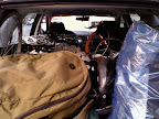
I arrived in Manhattan on Thursday with my Dahon packed and intact. This was my first time travelling with the Dahon packed up in its big suitcase, so I was a bit worried about how the airline might handle it. I had absolutely no problems with the bike on arrival, and as a bonus JetBlue didn’t even charge me the $50 bike handling fee. Although the case is a bit large and heavy (total weight = 44 lbs packed) I don’t think they realized that it was a bicycle. So... on Friday, Rachael and I packed up the car with our 3-bicycle stack and gear. We’re getting ridiculously good at this packing job; I actually think we could fit a fourth bike in this stack if we had to. Friday evening we headed up north to our first stop in Lake George. Along the way we were treated to a great fireworks show along the river in Albany. I’m not sure what the occasion was, but it was a cool treat.

Day 1: Lake George – Bolton Landing and Pilot Knob Loop (62 miles)
On Saturday we took advantage of the sunny weather to piece together two distinct loops in the Lake George area:

* Bolton Landing (30 miles, 2400 ft), on the west side of the lake
* Pilot Knob Loop (32 miles), on the east side


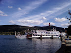
The Bolton Landing ride featured a nice stretch along the Lake George waterfront, then a bit of a climb up to Riverbank, followed by a nice meandering ride along Schroon River Road, which we had travelled on during our previous trip to the Adirondacks two summers ago. The second loop followed the south end of the lake, where the steamboats depart, and then followed the eastern edge of the lake. Along this side there were some marshlands that were in peak autumn color, and one of the highlights was a nice stretch along a beautiful rail trail between Glens Falls and Lake George.


Our accommodations in Lake George were great: a comfortable and cozy cottage at Cramer’s Point, complete with fireplace! With the innkeeper's help we built a nice roaring fire on Saturday night. Perfect for a chilly autumn evening in the Adirondacks.

Next: Lake Taghkanic, Hills and farms of Columbia county

Monday, September 14, 2009

Tour de Tahoe – “Bike Big Blue” ride (73 miles)

This Sunday’s ride was the Tour de Tahoe – Bike Big Blue ride around Lake Tahoe. The 72 mile loop circumnavigates the lake and is a moderate ride with somewhere between 2600 and 4500 feet of climbing, depending on whether you go by the official website or bikely.com’s elevation calculation. I’m going to guess it’s about 3500 feet of climbing total, over mostly rolling terrain, a couple of notable climbs, and several fast descents.

I got a relatively early start on Sunday morning.. was in the Horizon parking lot by 7 and crossing the start line by 7:05. We had had thunder storms the previous day, but Sunday morning was relatively clear and just a bit chilly. Outside of South Lake Tahoe, around mile 10, we began the first major climb of the day up towards the top of Emerald Bay. Driving around the lake, this is the sketchiest stretch of road. It’s very narrow, no shoulder, steep drop-offs, switchbacks, etc. Near the top there’s a narrow finger of highway with the bay on one side and Cascade lake on the other:

From Tour de Tahoe


On the bike it was actually not too bad. It was early enough that there were very few cars on the road, and there were only one or two short sections that were steep. The first rest stop was just past the top of the climb, at the parking lot for Vikingsholm Castle. This is a cool historic house that offers guided tours (I’ve toured this house before on a prior visit).

The next stretch of the route was really easy, with a long descent and then a flat section through the second rest stop at Homewood. Past Homewood the route continues through Tahoe City with an annoying but short climb up Dollar Hill. This was the stretch where I was feeling a little bit of the altitude, as the lake is at 6200 feet and the highest point of the route is at about 7100 feet.

Lunch was at Kings Beach, at mile 42. It wasn’t anything fancy, but they had subs, chips, cookies, and a pretty nice view.

After the lunch stop we cruised through Incline Village and Crystal Bay (amazing mansions lining the lake there) and then began the long slog up toward Spooner lake. This climb shouldn’t have been that tough – it was only 1000 feet gain over 7 miles or so, but in the heat of the day it was a bit rough. At the summit there was one last rest stop and then more or less 12 miles of descent to the finish line.

The organized ride was pretty good, but this route would be well-suited to a self-supported ride. Most of the southern and western shores have a dedicated multi-use path just off the highway, with the exception of the portion around Emerald Bay. The Nevada side has a bike lane almost the entire way. And there are plenty of little towns all along the route for food and services.

Sunday, July 12, 2009

Death Ride Report – 3 passes

Coming up to Tahoe mid-week to get ready for the Death Ride, I had more or less decided that I could really only do 2 passes rather than the 3 I had originally wanted to tackle. Work had been utterly ridiculous the past few weeks, really interfering with my training schedule. Then everything came to a head this past week and I had only gotten a few hours sleep each night. I was really not very optimistic about my performance on Saturday.
We arrived Wednesday evening and did a quick ride up Blue Lakes road. Checked in on Thursday and again did Blue Lakes. Friday I just did an easy, flat ride around South Lake Tahoe and got the bike ready for the big day. Saturday morning I was up at 3:30 am and over to pick up CCB by 4:20. We were out at the ride start and on the road by 5:20am.

From Death Ride 2009


Monitor Pass was once again a real pleasure to ride, and it seemed just a little bit easier this year than last. My post-ride data analysis shows that I climbed up Monitor slightly faster this year than last, this despite the heavier bicycle (Artemis) and my lack of fitness. [Speaking of Artemis, I must have gotten over 2 dozen compliments on the bike at various stages of the ride.] I think the granny gears on the touring bike probably helped since I was able to spin more and feel more relaxed on the climb. CCB and the others were all spread out over the course (all doing the 5 pass ride) but I ended up riding for a while with a woman from Portland who was going the same pace. I arrived at Monitor summit at 7:50am, feeling good.

After the beautiful, thrilling descent down Monitor, I headed in the direction of my second pass, the front side of Ebbetts. I saw Richard at Ebbetts base camp rest stop, and John, CCB, and Craig all passed me on the way up. I was feeling really comfortable up Ebbetts, even thinking that I could definitely go for the third pass. But then I got to within 3 miles of the summit and the nasty steep parts hit me like a ton of bricks. I had to stop every mile to catch my breath and let my heart rate drop down to something reasonable. Finally I made it to Ebbetts summit at 11:30am, and I was prepared to have a quick snack and call it a day.

I was standing next to my bike and someone asked me how many passes I was doing (this is the main conversation small talk at the rest stops). I broke down my initial plan to do three but then said I had decided not to do the back side of Ebbetts. This woman who was relaxing nearby said, Oh you should totally do the back side of Ebbetts. It’s the easiest of all the passes, it’s only 5 miles, and the first mile is flat and the last mile is flat. So it’s really only 3 miles of climbing.

I was all, “Really?” Cause my riding crew had said this pass was pretty tough. The woman assured me that I could do it and that it would only take me an hour. An hour.
I don’t know if it was the heat or dehydration or what, but I decided to go for the third pass. I filled up my water bottles and headed down the back side of Ebbetts to Hermit Valley. Then the deal is, you turn around and climb back up the same way. It’s about 5.5 miles and 1700 feet of elevation.


As I was descending to Hermit Valley, I was looking at the road grade and watching the hordes of people struggling up the ascent. My first thought was , Fuck. It was clear to me that it was not easy, nor flat, nor an hour’s worth of climbing. But at that point I was committed, so I cruised all the way down to Hermit Valley, got more water and used the pit toilets, then prepared to head back up. I ran into Craig down at Hermit Valley too. He had spotted my bike on the rack and was surprised to see me at Hermit Valley. We headed up the pass but he didn’t dawdle since he still had Carson Pass to climb. It was 12:15pm.

So I rode up the back side of Ebbetts, which took me an hour and 45 minutes to go approximately 5.5 miles. I had to stop every half mile or so to get out of the sun and take a breather. The pass itself isn’t that bad, but after doing Monitor and the front side of Ebbetts, I just didn’t have any reserve energy left. There were lots of people struggling up this pass.. people hanging out at the side of the road, slumped over their handle bars, some people walking their bikes, several people being SAGed up to the summit.

One guy passed me and said, "remember, we paid to do this." Clearly everyone up there was a glutton for punishment.

As we neared the summit a rider pointed out stray red vines on the ground, a sure sign we were getting near the rest stop and goodies. Sure enough, I spotted the orange cones of the rest stop and actually teared up at the sight. I was really happy to be done with that pass.

After that, it was downhill to the lunch stop (which wasn’t that great.. weird sandwich wraps) and then on to Markleeville and up the 500 ft gain to Turtle Rock. Just like last year, that little hill nearly did me in. It was hot out by this point.. 95 degrees.. and there’s no shade on that approach, just the hot winds blowing in your face.Yuck. But I finally made it, rolled up the car at 3:45pm. Yay!


P.S. Congrats to CCB, John, Craig, and Richard, who all completed 5 passes. Nice job guys.

Ride Stats
Begin/End: 5:20am to 3:45pm
Mileage: 68 miles
Elevation gain (total): 8923 feet
Passes: Monitor Pass (3000 ft), Ebbetts front (3000 ft), Ebbetts back (1770 ft)
Max speed: 53.1 mph, coming down Monitor
Slowest speed: 2.5 mph, climbing up Ebbetts from Hermit Valley

Sunday, June 28, 2009

2 weeks till Death Ride

This was the last weekend of official Death Ride training. After this point I'll be doing easy workouts and easy rides for the most part, gearing up to July 11th.

On Saturday, I had planned to do two times up Diablo North Gate to Juniper campground, and then one leg up South Gate to the junction. That would have given me about 7000 ft of climbing. But it was so hot on Diablo on Saturday, I had to cut my ride short. The air temp was 97 degrees, and the asphault felt way hot than that. I could feel the heat coming up through my cycling shoes on each pedal stroke. Anyway, I did one trip up North Gate to juniper, then once more up North Gate to about where the ranch is, just before the switchbacks. I figure that's around 4500 ft.

To supplement, I did 1.5 times up to Skyline today, total of about 2000 feet of climbing. It'll have to do. Just like last year, I wish I had done more training, especially during the week. But work craziness really got in the way.

Climbing up North Gate on Saturday, listening to my ipod, I had a great idea: my mother gave me this battery operated speaker set for an ipod. I'm going to take this with me on the Death Ride, strap it onto my trunk bag, and I'll have tunes to keep me going. I'm already putting together my Death Ride playlist, and it's going to rock!

Monday, May 25, 2009

Diablo junction x2 - almost

This morning was once again overcast, so I headed out east to find some sunshine. I debated doing a couple of different rides (possibly Morgan Territory) but in the end decided to go back to Mt. Diablo. At this point last year (May 25th in fact) I rode up to the ranger station on Diablo twice, so I figured this would be a good milestone for me to hit this weekend.

The weather was perfect: sunny, warm, slight breeze, just great conditions for a ride. Going up North Gate I tried to push myself a little bit more than I had on Saturday, particularly on the final third with the switchbacks. I ended up making it to the junction in 76 minutes, which is still hella slow but not as epically slow as the 83 minutes it took me on Saturday. I'd like to get that down to 65-70 minutes in the next 6 weeks.

From the junction I headed down South Gate and then turned around at the base and came back up. I didn't quite go all the way back to the ranger station, but rode as far as the Rock City flats before turning around and heading to Danville for a snack. Energy level was ok; I certainly felt fatigued but probably could have made it to the junction. What ended up bothering me was my lower back. So I need to get back into doing some exercises to strengthen my core a bit. Other than that, it was a good ride. I'm feeling a little bit better about my chances for the Death Ride after this weekend's training.

Sunday, May 24, 2009

Recovery ride - Orinda/Danville/Lafayette (30 miles)

Today was my recovery day between climbing days, so I just took it easy and did a flat spin from Orinda to Danville and then back to Lafayette to catch BART. About 30 miles total. In Danville, KC and I stopped for lunch at a place called Pete's Brass Rail and Car wash that has neither a brass rail nor a car wash but good burgers and several draft beers. We were the only ones sitting out on the patio, what with the marine layer still hovering all the way out in Danville of all places. When a few other folks did show up they actually turned on the heat lamps. It was cold.

Tomorrow, if the cloud cover is still around, I'm going to skip Mt Tam and head east to find some sunshine.

Saturday, May 23, 2009

Diablo to the summit

Today I had planned to go over to Marin and ride up Mt Tam, but I woke up to a thick marine layer, which would mean freezing temps over the Golden Gate bridge and a cold cloudy ride up Tamalpais. No fun. So, change of plans: instead I took BART out to Walnut Creek for a ride up to the summit of Diablo. This was my first ride up to the summit this season, and I felt pretty darn good. Although, I'm riding super slow these days on the Tournado, at least on the initial 6.5 miles up to the junction. Here's the data:

Last year, riding the Dolce:
5/11/08 - Up North Gate to the junction in 72 minutes
5/25/08 - 69 minutes
5/31/08 - 66 minutes
6/7/08 - 63 minutes!
3/8/09 - 72 minutes (ok, a bit slow, but early in the season)
5/23/09 - 83 minutes, a full 20 minutes slower than my best time last year in June

However, my times past the junction up to the summit aren't that bad. They're just a minute or two off my times last year. So I think what's happening is: when I climb I tend to spend a lot of time in my easiest gear, and my easiest gear is a lot slower on the Dahon. So, on the more moderate portion of the Diablo climb, I'm riding slower but probably more relaxed than on the Dolce. On the steeper parts above the junction, I really used to struggle on the Dolce but on the Dahon I can continue riding at a more relaxed pace and use some of the energy I conserved on the first part of the ride. So, all in all, it's not a bad thing. But it means that I may need to account for a slower pace on the Death Ride.

Riding up North Gate it was cold and blustery, but at about 2700 feet I emerged out of the cloud cover and it was sunny and warm the rest of the way up. You can see the marine layer hugging the hills to the west from Juniper campground (3000 feet):


At the summit there were lots of cyclists. One obnoxious guy was loudly telling everyone that he was training for the Death Ride and that it takes a *real commitment* blah blah. Dude, everyone's training for the Death Ride. Yawn. Another guy came over to compliment me on my Tournado. Everyone likes the old school stylings!

Ride Stats
Total miles: 38 miles
Total elevation gain: 3940 feet

Friday, May 22, 2009

Death Ride training

I've really been slacking off on the blog posting this year, mostly because of workload I guess. But that doesn't mean I haven't been riding! I've also been neglecting my mileage stats spreadsheet, which is a shame cause it's kind of like balancing your checkbook. Once it's out of date, you'll never get it back to its original state of accuracy.

Anyhoodle, since the Cinderella way back in April, I did the Wine Country Century with my buddies from NYC, but it was monsoon weather so R and I did the bailout route which still got us to 79 miles for the day. J was a machine and did the full century in the torrential downpour that seems to follow us where ever we ride.

After the WCC, it was time to start training seriously for the Death Ride. The weekend after the Wine Country Century, I did a nice ride up Mt Diablo to Juniper Campground. Last weekend we had a freak heat wave so I had to do a shorter mileage route but still managed to get some good climbing in. This weekend, I'm going to do two rides with some significant climbing:

Tomorrow (Saturday) I'm going to do the Mt. Tam loop, starting in the city and going clockwise. So, up Panoramic Highway to the junction, up to the summit, then heading north past Alpine Dam to Fairfax and then back down through the Marin valley to Sausalito. Should be 50-55 miles and 4500 feet of climbing.

Then on Sunday or possibly Monday, ride up Diablo to the summit.

Only 7 weeks left till the big ride.

Sunday, April 5, 2009

Cinderella 2009 (64 miles)

This weekend was the annual Cinderella metric century. I think this is the fourth year I’ve done this ride, and while I usually ride this one solo, this year I rode with a colleague who is training for the SF-LA AIDS ride this summer. She was also nice enough to give me a ride to the starting line (in Dublin/Pleasanton) since I’m currently car-less. Thanks Sharon!

In order to beat the bottleneck at the parking lot, we headed out pretty early and were in Pleasanton by 6:45 or so. It still took 20 or 30 minute to wind through the parking lot maze, but we were checked in and on the road by about 7:30.

The temperature was surprisingly chilly when we started out.. a guy passing by said it was 42 degrees. I was glad I had brought my leg warmers and ear warmers, but was still a bit cold throughout the day. Other than the cool temperature, it was a lovely day for a ride. It was very sunny and just a moderate breeze blowing mostly from the north. This meant that when we got to the standard “wind tunnel” part of the route, it actually wasn’t that bad. That part of the route travels mostly west with a few northerly jogs, so there were short patches of dealing with the wind, but not too bad.

My challenge was my continuing problem with my Dolce saddle. You might recall that last month I had bought a new Specialized Ruby saddle and had been initially happy at the lack of soft tissue pain. But then my sit bones ended up sore after 30 miles. So… I decided I just couldn’t ride that saddle on the Cinderella. Instead I fell back to my Brooks saddle that I had taken off the Terry. The Brooks was fine in terms of sit bones… no pain there. But after about mile 20 I started feeling it in the soft tissue. It got a little better near the end of the ride (or maybe I just had enough nerve damage to no longer feel pain?) but it’s definitely not going to work out long term. Back to the drawing board saddle-wise.

Last year I completed this ride in about 4 hours and 40 minutes (that’s time in the saddle). This year I didn’t push as much, since I was riding with my colleague who’s a little bit slower than me, although not really by much. I felt great pretty much the whole ride, with a little fatigue setting in around mile 50. But my cycle computer tells that that I had 5 hours and 25 minutes of active riding time! Now I’m thinking that 10 minutes of that time was actually walking back to the car after the expo, but still. That’s pretty slow.

Speaking of the expo, our friends at Rivendell had a booth this year. I don’t remember seeing them there before. They were showing off a couple of new models including a replacement for the Bleriot called the Sam Hillborne. About $2000 for a complete bike, and it looked real nice. I think I convinced my coworker to go visit them and talk to them about a new bike.

This was weird: we were riding through rural Livermore in the early part of the ride when we passed by a police officer pulling a blue tarp over a dead horse. It was very strange.. this big animal near the side of the road, with its hooves sticking out under this tarp. I noticed broken car glass around the area, so supposed a car ran into the horse..somehow. Googled it and apparently a pickup truck ran into the horse that had wandered into the road.


Total Distance: about 64 miles
Elevation gain: 23000 feet
Elapsed time: 5 hours and 15 minutes

Sunday, March 8, 2009

Walnut Creek-Diablo-Moraga Loop (40 miles)

Yesterday I spent about an hour and 160 bucks on a new saddle for my Specialized Dolce, so I was anxious to put it to the test on a longish ride. I’ve had a really hard time finding a replacement saddle that works for me on this bike. The saddle that came with it originally worked fine for a couple of years, but then started causing some discomfort during long ride... mostly soft tissue discomfort in the pelvic area. Thus began the search for a replacement saddle. I tried two different Terry saddles, neither of which worked, and then briefly tried putting one of my Brooks saddles on the bike, but that made the soft tissue discomfort worse. So, yesterday went down to Alameda Bicycle to check out the Specialized saddles, figuring that the original Specialized saddle had been the most comfortable of the lot. I tried a Jett first, and didn’t like that much, then tried a Ruby Gel and it felt pretty good on the spin around the block. Very firm but with a good cutaway so I didn’t feel any discomfort in the soft tissue area. Naturally it was the most expensive of the lot, because that’s how my butt rolls.

For this ride, I started in Walnut Creek and headed up North Gate. It was beautiful day for riding, light clouds, some sun, cool temps, but no rain. The ride up North Gate is pleasantly green from the recent rains, but alas very few wild flowers this season.

About a third of the way up I came across a loose dog.. I guess it was maybe a golden retriever, but had a reddish coat. He had tags with contact info, so he clearly wasn’t a stray. I hadn’t brought my cell with me, but a couple of other cyclists stopped and the woman called the owner. Strangely the owner didn’t seem in any kind of hurry to come and pick up his dog! He apparently said to point the dog in the direction of the trail and say “Go home!”. Cyclist woman was all, “that guy’s an idiot”. Seriously. You live 10 minutes away, someone calls to say they’ve found you’re dog, and you can’t get in your fricking car and go pick him up? What the hell man? The cycling couple took the dog with them down the hill, I guess in the hopes of intersecting with the owner. Hope that worked out.

I continued up the hill with some aspirations of getting to the ranger station under an hour. 2 miles from the station I started shooting for 65 minutes. That came and went and I was just trying to avoid logging my slowest time ever. Which I did avoid, but only by tie-ing my previous worst showing: 72 minutes. Blech. However I will note that the last time I logged this time up Diablo was last year in May, after I had completed the Wine Country Century and when I really started my Death Ride training. So, I guess I’m right where I should expect to be. But still, disappointing.

After the ranger station, headed down newly repaved South Gate, which is truly luscious with its brand new asphalty goodness. From the bottom of South Gate, headed to Danville, through Alamo, Lafayette, to Moraga, where I turned around and headed back to Lafayette to hop on BART.

So, the good news with the saddle: I had basically no soft tissue pain with this saddle, which is great! The bad news is that my sit bones began to ache around mile 30, making the final 10 miles of the ride kind of painful. In fact I really could have put in a few more miles, but just couldn’t stand being on the bike any longer. I’m hoping that the sit bone pain will go away once I get used to the saddle. Otherwise, I’m going to be quite annoyed.


Animules: horses, one loose dog, one wild turkey
Total Distance: 40 miles
Elevation gain: about 2500 feet
Time in the Saddle: 3 hours 45 minutes

Saturday, February 28, 2009

Chabot loop from Rockridge (about 40 miles)

Browsing through my old blog notes, I was surprised to see that I had never written up this route, since I used to ride variations of it fairly often. I guess I haven’t done this ride for a while, and after today, I think I remember why. It’s not a terrible ride, but it’s a bit utilitarian, not very scenic, a bit ghetto, and slightly annoying with the hill profile. On the up side, it’s an easy way to get in a 40 mile loop from my front door. This ride is based on the Oakland Yellow Jackets routesheet, with some minor modifications at the beginning and end.

From Rockridge the route follows the standard bike route down to uptown Oakland/Lake Merritt (basically following my commute route). Then around the lake, under the freeway, and over to Alameda. Alameda is a pleasant little island community that used to a big naval base in the bay area. I was pleased to see that they’ve added a dedicated bike lane on the approach to the bicycle bridge connecting Alameda and Bay Farm. Sweet! No more cutting across traffic and getting on the sidewalk to approach the bike bridge.

From the bike bridge I like to go around the miniature airplane airfield and head out towards the airport. There’s a dedicated bike lane that runs parallel to the airport access road, which is nice. Today it was a bit of a wind tunnel, with breezes blowing from the south. From the airport the route goes along busy boulevards of San Leandro, and at mile 20, starts a short climb up to Lake Chabot. The climb up Fairmont to Chabot is slightly longer than a mile but covers 500 feet in elevation gain, so it’s a bit of a pain.

After the climb, the first of two scenic sections begins: the ride alongside Lake Chabot. Unfortunately it’s all too short of a stretch, and pretty soon you’re back in San Leandro. Now from here there are a couple of ways to get back to Oakland. One is a straight shot through the San Leandro and east Oakland ghettos.. not very nice. The other principal way is to follow Mountain Blvd as it meanders along just at the base of the Oakland hills. This route is slightly less ghetto but annoying with the terrain. You’re constantly climbing short steep risers only to drop back down again, so you get the pain of climbing without the sense of accomplishment.

Past the Mormon Temple, at Park Blvd, instead of turning left to return to Lake Merritt I turn right to rejoin Mountain Blvd through Montclair, a really cute little town. Past Montclair, the road takes you to Broadway Terrace and Lake Temescal (cut through via the multi-use path). From here wind your way over to Chabot Road in Rockridge and you’re done.


Total Distance: about 40 miles
Elevation gain: 2300 feet
Routesheet (on bikely.com): Chabot Loop from Rockridge

Saturday, February 21, 2009

Time Trial: Old Tunnel Road

My three readers will recall that last week when I did my time trial route I was pretty disappointed in my time: 55 minutes elapsed from Claremont/College up to Grizzly Peak. This week I rode the same route on the aluminum frame Specialized Dolce, and my elapsed time was 49 minutes. This is much more in line with my expectations, and consistent with times logged last January at the beginning of the season.

6 minutes is a lot of time to shave off a 5 mile ride, and I know I didn’t improve my fitness in the past week. So, what happened last week? I think part of it has to do with the difference in the bikes. Artemis is a bit heavier and has much wider plusher tires. I think Artemis has 700x35s where the Dolce has 700x23. The two bikes also have completely different gearing, both in terms of the cassettes and the chainrings in front, with the result being that the touring bike has a couple more easier gears than the Specialized road bike. I think I may be hanging out in those granny gears a bit longer than I really need to, and that may account for the slower overall time. Next time I take the touring bike on the time trial, I’m going to try to stay out of my two easiest gears as much as possible to see if I can improve my time on that bike.

I was pretty happy with my time today, and it was nice to take the Dolce off the indoor trainer and get it out on the road for a change. I’ve been neglecting this bike a bit since I got the new touring bike in the fall, so it felt good to take it out for a spin.

Bike: Specialized Dolce
Total Time Clocked, from Claremont/College to Grizzly Peak: 49 minutes
Actual Ride time: unknown; probably 48 minutes
Total Distance: 5.4 miles

Monday, February 16, 2009

Time Trial: Old Tunnel Road

The rained stopped for about 2 hours today, so I hopped on the bike for a quick ride up Old Tunnel. About half way up I decided to make this a time trial, and I'm afraid the results were pretty sad. 55 minutes to get from Claremeont/College to Grizzly Peak! Last January I clocked this at 49 minutes elapsed time (actual ride time is usually 2.5-3 minutes less due to 2 stop lights).

Now, I am riding a slightly different route up through Claremont, and that adds about 3/10 of a mile to the total. And I'm riding the heavier Tournado with the fat tires, but still. Looks like I've got a lot of training to do.

Bike: Artemis (Dahon Tournado)
Total Time Clocked, from Claremont/College to Grizzly Peak: 55 minutes
Actual Ride time: unknown; probably 52 minutes
Total Distance: 5.4 miles

Monday, January 19, 2009

Tale of Two Climbs

Seems like forever since I've done a serious ride, but I was able to take advantage of the three-day weekend to get in two climbs: one up to the ranger station on Tam, and the other up to the junction on Diablo.

The weather was perfect this weekend: sunny, warm, and clear. The unfortunate result of a drought that will probably produce lots of fires this summer, but for now it's great cycling weather. So, Sunday went riding in Marin with kc and his friend Roxanne. She's on the short side, but I was able to drop down the handlebars and seat post on the Terry for her, and that seemed to work well. That means with my growing fleet of bikes I can accommodate visiting cyclists from 4'11" to probably 5'9".

We parked near the multi-purpose trail in Marin City, north of Sausalito, and then did the Stinson Beach/Muir Woods loop clockwise. I've always done this ride counter-clockwise, but took a chance that maybe the climbing would be a bit better doing it in reverse. Following the route clockwise, you climb up through residential areas of Mill Valley, cross Panoramic Highway, then drop down to Muir Woods. From Muir Woods there's a bit of a climb (500') to get up to Highway 1 on the coast. That climb was a bit of a pain, and there were easterly winds up on the ridge, but going north on Highway 1 was pretty painless, and the view was great.

We stopped briefly in Stinson Beach before beginning the principal climb up to the Pantoll Station on Mt Tam. This climb is about 1500' over the course of 4 miles, but it's a great climb. It's very evenly graded, without any steep sections, and the second half is entirely shaded by forest. I felt awfully sluggish on all the climbs on this ride. Even kc was up ahead of me pretty much all day, which almost never happens. After the final climb it was a quick descent back to Mill Valley for lunch at the flatbread place. Yum, flatbread!

Route sheet: Muir Woods/Stinson ride
Total distance: about 27 miles
Total elevation gain: about 3000 feet

On Monday I BARTed out to Walnut Creek at a painfully early hour to meet ccb and his crew for a ride up to the Diablo junction. The temperature was cool when we started out, but it warmed up nicely and ended up being a great morning for a ride up North Gate. I rode slowly, but didn't feel as sluggish as the day before. Also my headache pressure wasn't as pronounced for the first time in at least 2 weeks (long story). From the junction, we headed down the newly paved south side and over to Danville for a java before heading home. All in all a good mid-January ride.

Distance: about 30 miles
Elevation gain: 2300 feet