Well, I've still got two more days to add to the tally, but the initial stats for calendar year 2007 are:
Total miles logged: 4199
Total time in the saddle: 372 hours
Woohoo! Next up, cycling goals for the new year...
Update: I managed to get in two more rides before the end of the year, so the final numbers for 2007 are 4241 miles and 376 hours in the saddle.
Saturday, December 29, 2007
Sunday, December 16, 2007
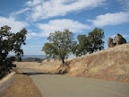
Grizzly Peak Pinehurst Loop (38 miles)
For today's ride I wanted something that would give me a nice climbing workout without having to travel too far. Luckily I've got the east bay hills pretty much at my doorstep, so I decided to do a ride that would provide a kind of hill interval workout. This ride is similar to the East Bay Hills Ramble Lite, except instead of entering Tilden via Spruce Avenue in Berkeley, you take Old Tunnel Road up to Grizzly Peak and then follow Grizzly Peak to Tilden.
The weather was in the mid-40s, so it was bearable out if not exactly what I would call comfortable. The only time I felt really, really cold was on the final descent down Old Tunnel Road back into Oakland. By that point my feet were numb (even with my half-booties over my shoes) and I was questioning my sanity a bit. Once I had a cactus burrito in my belly, I felt better.
The basic profile of the ride is:
1. Old Tunnel Road to Skyline: an easy-to-moderate climb averaging 4-5% grade over 3 miles.
2. 1st part of Grizzly Peak: flattish for about 2 miles as you cruise along the ridge
3. Climb to Tilden: a short, moderate climb up to the boundary of Tilden Park
4. 2nd part of Grizzly Peak: flat again for a couple of miles
5. into Tilden: flat to rolling through the park
6. Wildcat Canyon descent
7. Moraga Way: an easy gradual ascent, probably 2-3%, over 3 miles
8. 1st part of Pinehurst: flat to rolling, gradual ascent, 3-4%?
9. 2nd part of Pinehurst: moderate climb with a steep finish
10. Old Tunnel descent back to town
So there's a good variety of climbs interspersed with rest periods. You can check out the elevation profile for the route as well, but I've noticed lately that the elevation functionality on Bikely seems to be crapping out more and more. Like on this profile it looks like I drop off a cliff around mile 15 then spring back up to 500 feet around mile 20. Odd.
Animules: none; hibernation?
Total Distance: 38 miles
Elevation gain: about 4500 feet
Time in the Saddle: 3 hours 45 minutes
Route (bikely.com): Grizzly Peak Pinehurst Loop
Saturday, December 15, 2007
Death Ride
My boss' boss' boss, Paul, is a hard core cyclist. You know, the kind who goes up and down Mount Diablo two or three times in a row just for kicks. I usally say he's a crazy hard core cyclist, but when I'm considering doing something called the Death Ride, it becomes a kind of pot/kettle situation. Paul emailed me yesterday to encourage me to register for the Death Ride lottery, and after giving it some thought, I went ahead and signed up.
The Death Ride is a ride over 5 passes in the Sierras, just south of Lake Tahoe. The total distance if you do all the passes is 129 miles, with 15,000 feet of vertical climbing. But you don't have to do all 5 passes, and because the way the course is arranged with a bunch of out-and-backs from a central point, you could do just one or two passes and call it a day.
I'm pretty sure I could do at least one pass on this ride. Monitor Pass begins at around 5500 feet and peaks at 8300 feet, so total elevation gain is about same as going up Mount Diablo. Of course you're starting at a high elevation, so altitude can be a factor. I don't think I would do the back side of Monitor, which is the second pass, but I might try Ebbett's Pass, which goes from 6000 to 8700 feet, but is supposed to be quite a bit steeper than Monitor. The back side of Ebbett's is a shorter pass, so three passes might be within my reach.
The way this registration works is, you sign up now and then in February they randomly select 2800 participants. Then you have one month to confirm and pay the entry fee. So I may not get selected, but if I am I have a lot of training to do between now and July.
Sunday, December 9, 2007
Indoor Trainer workout #1
It was a bit too chilly today for a real ride (at least that's my story), and so I decided to dust off the ol' trainer and take a spin inside where it was nice and warm and there weren't any holiday shoppers in their SUVs yelling at me to "ride on the sidewalk". And anyway, who doesn't love hooking a bicycle up to the trainer and doing the 'sit and stare' workout for an hour?
I own a couple of these cycling workout DVDs, which I thought would alleviate the boredom a bit, and they do, but I can only watch them once or twice during the off-season because the annoyance factor is so high. The host is kind of a Jeff Probst type (although with more credibility) who circulates among the huge spin class group with this peppy electro-muzac soundtrack playing in the background. The DVD case says: "Train your Aerobic Base with over 95 Cyclists from Ft. Wayne, Indiana!"
So I've devised my own interval workout, outlined below. If I were a writer for Bicycling magazine I'd throw out some pseudo-scientific sports mediciny explanation of the benefits of this workout. But I'm not, so I won't. I think I should come up with a name for my workout though.. maybe Cynical Intervals, or Cynervals.
Cynerval Workout #1
5 min: warm up spin
5 min: ok, warm up is over, time to crank it up a bit, but not too much! This is like you're on a nice wide multi-use path on a foggy day. The path is empty and there aren't any stop signs or lights, so you can just cruise along at a nice brisk pace.
10 min: intervals - 1 minute at your brisk spin pace, then shift into your biggest chainring in front and smallest cog in back. Pedal for 1 minute maintaining the same cadence. Repeat the intervals for 10 minutes.
5 min: spin
5 min: Get Off Your Ass intervals - Shift into your highest gear again and pedal out of the saddle for 30 seconds, then in the saddle for 30 seconds, out of the saddle for 30, etc.
5 min: spin
5 min: GOYA intervals
10 min: spin/cooldown
Soundtrack: Screaming Trees: Sweet Oblivion
Sunday, December 2, 2007
Walnut Creek-Mt. Diablo Loop (35 miles)
Well I've been wondering at what point it would just get too cold to ride. Today I discovered the answer is: at about 3200 feet up Mt. Diablo, just shy of the summit. I started out this morning knowing it would be cold and gusty. Weather.com had predicted highs in the 40s with winds 15-20 mph. But still, I was surprised when I started up South Gate and there were hardly any other cyclists on the road. Usually, Diablo is packed with all kinds of bicyclists, dozens and dozens of them. Today there were a few coming down the hill, but I only encountered a couple on the way up. Weird.
Once past the rangers station and on my way up summit road, it dawned on my why I had the place all to myself. It was fucking freezing up there! If it was in the mid 40s down at sea level, it must have been in the 30s up at 3000 feet, especially with the wind chill. I turned back with about a mile and half to go till the summit, and then shivered my way through a frigid 10 mile descent.
So, a good ride, but probably my last ascent up summit road until spring.
Animules: one gray fox crossing South Gate road
Total Distance: 35 miles
Elevation gain: about 3200 feet
Time in the Saddle: 3 hours 25 minutes
Saturday, December 1, 2007
Sunday, November 25, 2007
East Bay Hills Ramble Trois? (40 miles)
Today's ride was another variation of a ride in and around the East Bay hills. Basically there are several ways to enter the hills and several ways to exit, so there are lots of rambles possible. If I had time I'd draw up a decision tree of all the possible entrances, turns, and exits. That would be really cool.
Anyway, today's route enters the Berkeley hills via Spruce Avenue, travels through Tilden Park to Orinda and Moraga, then into the Oakland Hills and along the ridgeline to Castro Valley. From Castro Valley I had planned on circling by Lake Chabot, but Lake Chabot Road was closed for "tree disposal". So I had to take a detour that was significantly less scenic but with the same end point: San Leandro BART station.
Animules: None! Hiberation?
Total Distance: 40 miles
Total Time in the Saddle: 3.5 hours
Total Elevation gain: about 3700 feet
Bikely.com route map: East Bay Hills Ramble 3
Thursday, November 22, 2007
Mt Diablo lite (35 miles)
This morning, pre-turkey, I rode out to Danville and up to the rangers station on Mt Diablo. I had planned to go all the way up to the summit today, but it was windy and cold.. I think it was only in the 40s most of the morning, and I really started feeling the elements out there today. Even though it was cold, it was crystal clear and beautiful up on the mountain. The streets were deserted, but there were lots of cyclists riding up Diablo... everyone cleaning out their systems in anticipation of Thanksgiving feasts?
Sunday, November 18, 2007
Maui County Bicycle Map
While researching a bicyle touring vacation in Maui, I came across this Maui County Bicycle Map, which is kinda nice. It shows suggested routes around the island as well as some elevation profiles for some routes (including directional tradewinds).
Maui Bicycle Map
Unfortunately this online version is low-res, so I can't make out the elevation marks. Paia to Hana: does that max out at 1400 or 3400 feet or 5000 something? Inquiring minds want to know!
Maui Bicycle Map
Unfortunately this online version is low-res, so I can't make out the elevation marks. Paia to Hana: does that max out at 1400 or 3400 feet or 5000 something? Inquiring minds want to know!
Monday, November 12, 2007
Hike: Palomarin to Alamere Falls (7.5 miles)
We're fortunate in the bay area to have amazing natural environments right at our door step, and there are tons of hikes and nature walks available to explore all kinds of different terrain. Today's hike was a 7.5 mile out and back through the Point Reyes reserve, terminating in a waterfall pouring into the Pacific Ocean.
Bay Area Hiker has a good write up on this hike, which starts at the Palomarin trailhead, in the Point Reyes National Seashore. Point Reyes is a really interesting nature reserve, with lots of diverse ecosystems. The Point Reyes promontory has been migrating north over the last millions of years-- it used to be directly off the Monterey bay coast-- and the movement is somehow related to the San Andreas Fault, which separates the point from the coastal mainland. I wonder if this accounts for some of the diversity of the landscape.
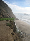 The hike follows the California Coastal Trail, and skirts several interesting coastal lakes before arriving at a junction with an unmaintained trail out to Alamere Falls, a nice tidefall. To get down to where the cascades hit the beach, there are a couple of pretty tricky scambles. I did the first one without any problem but then chickened out on the second. That's ok, even from the plateau 40 feet above the beach, the waterfall and scenery were really beautiful.
Round trip the hike took about 4 hours, including a significant break to allow for frolic time at the beach.
Bay Area Hiker has a good write up on this hike, which starts at the Palomarin trailhead, in the Point Reyes National Seashore. Point Reyes is a really interesting nature reserve, with lots of diverse ecosystems. The Point Reyes promontory has been migrating north over the last millions of years-- it used to be directly off the Monterey bay coast-- and the movement is somehow related to the San Andreas Fault, which separates the point from the coastal mainland. I wonder if this accounts for some of the diversity of the landscape.
The hike follows the California Coastal Trail, and skirts several interesting coastal lakes before arriving at a junction with an unmaintained trail out to Alamere Falls, a nice tidefall. To get down to where the cascades hit the beach, there are a couple of pretty tricky scambles. I did the first one without any problem but then chickened out on the second. That's ok, even from the plateau 40 feet above the beach, the waterfall and scenery were really beautiful.Round trip the hike took about 4 hours, including a significant break to allow for frolic time at the beach.
Sunday, November 11, 2007
Morgan Territory Loop (54 miles)
I've been meaning to do this ride for a while, and have just been waiting for the weather to cooperate. Today the conditions were perfect: we had a brief rainstorm move through Friday and Saturday, but it cleared up early Sunday morning. So it was sunny and dry, but cool. A perfect day for tackling a challenge like Morgan Territory.
Morgan Territory Road is a scenic country road that skirts the eastern side of Mt Diablo, and passes through the Morgan Territory Regional Reserve. The area is named for Jeremiah Morgan, who claimed the entire area as his own in the 1850s. While this road doesn't ascend Diablo itself, it does take you up to about 2000 feet, and the road in some parts is quite steep. So it's definitely not a gimme.
The loop begins and ends at Walnut Creek BART. The Oakland Yellow Jackets have a great turn-by-turn routesheet (pdf) that I more or less followed for this ride.
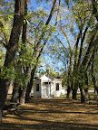
About 10 miles into the ride you'll pass through the town of Clayton-- first you'll hit the standard suburban sprawl portion of town, then the quaint old downtown area. Clayton is a good place to stop for food and drinks (lots of supermarkets and eateries, and I spotted a Peete's at mile 9.6), or you can make a pitstop at a nice park on Marsh Creek Road called Clayton Community Park. Restrooms and drinking fountains available here.
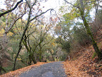 Marsh Creek Road has a lot of auto traffic and not much shoulder, but once I turned onto Morgan Territory Road, the traffic completely disappeared. In 9 miles I passed maybe 5 cars, and surprisingly didn't see any other cyclists. Weird. I had heard that Morgan Territory had lots of steep sections, but the first 6 miles were very gentle. I thought, Hey, this is easy! Then came the last 2-3 miles with lots of nasty steep climbing, but at least there were some stretches of more gentle grade to recover, and lots of shading for sun protection. This stretch of the road was heavily wooded, with oaks and.. other trees (despite that high school biology project that involved collecting all those tree leaves, they still all look the same to me). It almost reminded me of some of the scenery in New Jersey. Maybe my east coast readers will see the pics and disagree.
Just before the summit (around 2000 feet) is the Morgan Territory Reserve staging area, with pit toilets and not much else. There was a large orienteering group at the staging area while I was there. That always looks like fun to me; I should look into that and see what the deal is. Past the summit, you begin the descent into the Livermore valley area. It's really striking how quickly the scenery changes at this point. All of that shaded, wooded reserve gives way to arrid grazing hills that are bone-dry this time of year.
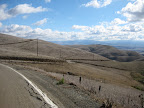 It was like turning a corner and finding yourself on another planet. It's a nice descent though: not technical at all, just a straight, fast shot down to the valley. Once there, the route follows Highland Road and Camino Tassajara (part of the Cinderella Century route-- beware the headwinds!) to return to Danville. Oh, and on Finley Road you have to check out the old Tassajara School, dating to 1889. Quaint!
From Danville it's a straight shot up Danville Blvd to the BART station.
Animules: one llama, many horses, some cows, three deer, lots of hawks
Total Distance: 54 miles
Elevation gain: about 3000 feet
Time in the Saddle: 5 hours
Route (on bikely.com): Morgan Territory Loop
Morgan Territory Road is a scenic country road that skirts the eastern side of Mt Diablo, and passes through the Morgan Territory Regional Reserve. The area is named for Jeremiah Morgan, who claimed the entire area as his own in the 1850s. While this road doesn't ascend Diablo itself, it does take you up to about 2000 feet, and the road in some parts is quite steep. So it's definitely not a gimme.
The loop begins and ends at Walnut Creek BART. The Oakland Yellow Jackets have a great turn-by-turn routesheet (pdf) that I more or less followed for this ride.
About 10 miles into the ride you'll pass through the town of Clayton-- first you'll hit the standard suburban sprawl portion of town, then the quaint old downtown area. Clayton is a good place to stop for food and drinks (lots of supermarkets and eateries, and I spotted a Peete's at mile 9.6), or you can make a pitstop at a nice park on Marsh Creek Road called Clayton Community Park. Restrooms and drinking fountains available here.
Marsh Creek Road has a lot of auto traffic and not much shoulder, but once I turned onto Morgan Territory Road, the traffic completely disappeared. In 9 miles I passed maybe 5 cars, and surprisingly didn't see any other cyclists. Weird. I had heard that Morgan Territory had lots of steep sections, but the first 6 miles were very gentle. I thought, Hey, this is easy! Then came the last 2-3 miles with lots of nasty steep climbing, but at least there were some stretches of more gentle grade to recover, and lots of shading for sun protection. This stretch of the road was heavily wooded, with oaks and.. other trees (despite that high school biology project that involved collecting all those tree leaves, they still all look the same to me). It almost reminded me of some of the scenery in New Jersey. Maybe my east coast readers will see the pics and disagree.Just before the summit (around 2000 feet) is the Morgan Territory Reserve staging area, with pit toilets and not much else. There was a large orienteering group at the staging area while I was there. That always looks like fun to me; I should look into that and see what the deal is. Past the summit, you begin the descent into the Livermore valley area. It's really striking how quickly the scenery changes at this point. All of that shaded, wooded reserve gives way to arrid grazing hills that are bone-dry this time of year.
It was like turning a corner and finding yourself on another planet. It's a nice descent though: not technical at all, just a straight, fast shot down to the valley. Once there, the route follows Highland Road and Camino Tassajara (part of the Cinderella Century route-- beware the headwinds!) to return to Danville. Oh, and on Finley Road you have to check out the old Tassajara School, dating to 1889. Quaint!From Danville it's a straight shot up Danville Blvd to the BART station.
Animules: one llama, many horses, some cows, three deer, lots of hawks
Total Distance: 54 miles
Elevation gain: about 3000 feet
Time in the Saddle: 5 hours
Route (on bikely.com): Morgan Territory Loop
Monday, November 5, 2007
Good eats: Cab-braised short ribs
One of the things I like to do after a long ride is prepare (and consume) a really nice meal. I don't know why, but almost any food is extra tasty after a long, hard ride. When I come across a particularly tasty post-ride meal, I'll post the recipe here.
This past Sunday, after coming very close to getting to the summit of Mt. Diablo, I treated myself to cabernet-braised short ribs, roasted red and sweet potatoes, and roasted brussel sprouts. For the short rib preparation, I essentially followed the recipe at Bon Appetit. This is really pretty simple:
First, you want to season the short ribs a day in advance and just put them in the fridge over night. Lay the ribs (I had about 2.5 lbs of them) in a glass pan and sprinkle generously with a mixture of kosher salt, pepper, fresh thyme, and fresh rosemary (about 1 tbsp of each). Cover and chill overnight.
To continue-- heat some olive oil in a heavy pan over medium heat and brown the short ribs, about 6-8 minutes on each side. Transfer ribs to a plate and drain off the oil from the pan. Next pour a full bottle of Cab (I just used two buck Chuck) into the pan and bring to a boil, scraping up any browned bits on the pan. I added some vegetable stock at this point too, just for kicks. Return the ribs to the pan, reduce the heat to a low simmer, cover, and let it cook for a good hour and 15 if not more. Note that Bon Appetit calls for this to braise in the oven but since I don't have a suitable dutch oven I prepared this entirely on the stove top.
While the ribs are simmering away, cut up some new red potatoes and small sweet potatoes into chunks, toss with olive oil, thyme, and rosemary, and place in a single layer in a parchment-lined baking dish. Put these into the oven (350-375) about 45 minutes before you're planning on serving dinner. After that, clean some brussel sprouts, cut in half, and similarly toss in a bit of olive oil, thyme, and rosemary. Place these, cut side down, in another parchment-lined baking dish. These will only take 15-20 minutes to roast, so put them in last.
Now, when your short ribs are tender, remove them from the braising sauce and set aside, covered with foil to keep them warm. To thicken the wine sauce, combine 1 tbsp butter and 1 tbsp flour in a small bowl, combine into a paste, and then whisk into the simmering wine sauce until it thickens. The sauce should be well-seasoned already, but you can add more salt/pepper if desired.
Serve the short ribs with the sauce drizzled on top and the potatoes and brussel sprouts on the side. Don't forget to open another bottle of Cab to drink along with the ribs.
Sunday, November 4, 2007
Lafayette-Mt. Diablo Loop (42.5 miles)
Today I came this close to making it up to the summit of Mt. Diablo. Even though I didn't make it up there today, I did go farther up than on my last trip, and I'm pretty sure that next time I'll be able to get my ass up to the top without too much trouble.
Like last time, I began at Lafayette BART station, which gives me a nice warm-up of 12-13 miles before starting the real climb. Unfortunately I again consumed 4 cups of java before heading out and again had trouble finding a restroom before hitting the mountain. Last time I passed up a porta-potty at a park that was under construction, in the hopes of finding a better option (yes that was stupid). This time I stopped at that park and the construction is finished, so no more porta-potty. Argh. Luckily they are doing some re-paving at the Athenian School at the base of Diablo, so there's a pit toilet there for now. But I really need to map out some better break spots, because I feel like I'm at the mercy of the construction crews in the San Ramon valley.
I wasn't really feeling 100% today, and it was pretty warm up on the mountain... probably around 75 degrees, which is too goddamn hot for November if you ask me. So I think it took me a bit longer to get up to the rangers station. At that point I took the turn up Summit Road for the first time ever. I was expecting it to be harsh, because it's supposed to be much steeper than either approach to the rangers station. But actually it really wasn't too bad. From the rangers station to the summit is 4.5 miles, and I made it up to Juniper campground, 3000 ft and 2 miles from the summit, when I ran out of water. And, because this is the kind of luck I have, none of the water spigots are working on the mountain right now. Apparently they've turned off all the water because they're low. Fair enough, but still... it's a problem if you're out there and dehydrated, no? At the campground I ran into a park ranger, Sam, who gave me one of his extra water bottles. Thanks Sam! Since I was already a bit dehydrated, I didn't want to push it, so that's when I decided to head back down. Next time I'll hydrate better and bring extra water.
 Heading back down North Gate was pleasant.. I stopped to take a few pics along the way. Instead of finishing up at Pleasant Hill BART I looped back over to Lafayette for a quick BART ride home.
Animules: horses, one dead squirrel
Total Distance: 42.5 miles
Elevation gain: about 3000 feet
Time in the Saddle: 4 hours
Route (on bikely.com): Lafayette-Mt. Diablo
Like last time, I began at Lafayette BART station, which gives me a nice warm-up of 12-13 miles before starting the real climb. Unfortunately I again consumed 4 cups of java before heading out and again had trouble finding a restroom before hitting the mountain. Last time I passed up a porta-potty at a park that was under construction, in the hopes of finding a better option (yes that was stupid). This time I stopped at that park and the construction is finished, so no more porta-potty. Argh. Luckily they are doing some re-paving at the Athenian School at the base of Diablo, so there's a pit toilet there for now. But I really need to map out some better break spots, because I feel like I'm at the mercy of the construction crews in the San Ramon valley.
I wasn't really feeling 100% today, and it was pretty warm up on the mountain... probably around 75 degrees, which is too goddamn hot for November if you ask me. So I think it took me a bit longer to get up to the rangers station. At that point I took the turn up Summit Road for the first time ever. I was expecting it to be harsh, because it's supposed to be much steeper than either approach to the rangers station. But actually it really wasn't too bad. From the rangers station to the summit is 4.5 miles, and I made it up to Juniper campground, 3000 ft and 2 miles from the summit, when I ran out of water. And, because this is the kind of luck I have, none of the water spigots are working on the mountain right now. Apparently they've turned off all the water because they're low. Fair enough, but still... it's a problem if you're out there and dehydrated, no? At the campground I ran into a park ranger, Sam, who gave me one of his extra water bottles. Thanks Sam! Since I was already a bit dehydrated, I didn't want to push it, so that's when I decided to head back down. Next time I'll hydrate better and bring extra water.
Heading back down North Gate was pleasant.. I stopped to take a few pics along the way. Instead of finishing up at Pleasant Hill BART I looped back over to Lafayette for a quick BART ride home. Animules: horses, one dead squirrel
Total Distance: 42.5 miles
Elevation gain: about 3000 feet
Time in the Saddle: 4 hours
Route (on bikely.com): Lafayette-Mt. Diablo
Wednesday, October 31, 2007
October mileage stats
Total mileage was way down this month... the lowest my mileage has been since the beginning of the calendar year (January 2007, 273 miles). I missed one weekend of riding while in Dallas/Ft Worth at the beginning of the month, but mostly I think it's just my normal slowdown at the end of the riding season.
I did have some high quality rides in October though: I climbed Mt Hamilton and did some good riding in and around New York.
October mileage: 286
October Time in the Saddle: 26.2 hours
I did have some high quality rides in October though: I climbed Mt Hamilton and did some good riding in and around New York.
October mileage: 286
October Time in the Saddle: 26.2 hours
Sunday, October 28, 2007
Orinda-Sunol-Union City (62 miles)
This ride is a bit of a hybrid, combining the first 45 miles of the Orinda-Palomares ride with a jaunt down the Alameda Creek path and a quick turn through urban-industrial Union City. This is another BART-to-BART ride: the route begins at Orinda BART station and finishes up at South Hayward BART.
The stretch from Orinda to Sunol (i.e the first 40 miles or so) has become one of my favorite standard rides this season. It's a really pleasant route that's relatively flat without too many stops or lights, so you can really speed down to Dublin/Pleasanton in no time.
Instead of taking the turn up Palomares Road, I stayed on Niles Canyon and picked up the Alameda Creek trail at Mission. I followed the trail to Union City Blvd, then headed north to Industrial Parkway. Obviously this is a utilitarian route rather than a scenic one, but it's a straight shot down Industrial Parkway to South Hayward BART. Besides, there aren't a lot of scenic options through Union City and Hayward, so you sort of have to settle for the functional.
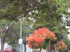
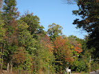
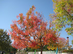 While out and about I was keeping an eye open for changing fall colors. Being in New York last weekend got me thinking about fall foliage, so I've been on a mission this week to spot any isolated trees in the bay area that are undergoing an autumn transformation. From what I can tell, the hills around here don't have too many trees that change, but scattered throughout many residential areas (including my own) there are lots of these little trees that are changing to a very bright red. Wonder what kind of tree that is...?
Animules: horses, and some pasturing cows in Union City
Total Distance: 62 miles
Elevation Gain: 1400 feet
Route (on bikely.com): Orinda-Sunol-Union City
The stretch from Orinda to Sunol (i.e the first 40 miles or so) has become one of my favorite standard rides this season. It's a really pleasant route that's relatively flat without too many stops or lights, so you can really speed down to Dublin/Pleasanton in no time.
Instead of taking the turn up Palomares Road, I stayed on Niles Canyon and picked up the Alameda Creek trail at Mission. I followed the trail to Union City Blvd, then headed north to Industrial Parkway. Obviously this is a utilitarian route rather than a scenic one, but it's a straight shot down Industrial Parkway to South Hayward BART. Besides, there aren't a lot of scenic options through Union City and Hayward, so you sort of have to settle for the functional.
While out and about I was keeping an eye open for changing fall colors. Being in New York last weekend got me thinking about fall foliage, so I've been on a mission this week to spot any isolated trees in the bay area that are undergoing an autumn transformation. From what I can tell, the hills around here don't have too many trees that change, but scattered throughout many residential areas (including my own) there are lots of these little trees that are changing to a very bright red. Wonder what kind of tree that is...?Animules: horses, and some pasturing cows in Union City
Total Distance: 62 miles
Elevation Gain: 1400 feet
Route (on bikely.com): Orinda-Sunol-Union City
Saturday, October 27, 2007
NY Dining: wd-50
When R told me that we were going to a resto called wd-50, I wasn't sure what to expect. Apparently I'm the only person on the planet who wasn't familiar with the head chef, Wylie Dufresne. I've since mentioned his name in conversation and everyone is like, Of course, Wylie Dufresne. I'm always the last to know. Anyway, Dufresne made an appearance in the season finale of Top Chef 2, and it was through the show that I was familar with the concept of molecular gastronomy. So, anyway, I was kind of expecting everything to come with foam, Marcel-style. And I figured it would definitely be a unique experience, but I wasn't prepared to be really blown away by the concept, creativity, and flavor of every dish we had.
At J's suggestion, we opted for the 12 course tasting menu, and we were certainly not disappointed. Only the opening course, a delicious seared bonita with pistacio paste, was commonplace. Most of the other courses exhibited a culinary creativity that I don't think I've experienced before. I'm still not exactly sure what molecular gastronomy means (or whatever term they're using this week), but my impression was one of analysis and synthesis. For some courses it seemed like we were deconstructing a familiar item into its fundamental components and then reconfiguring each component slightly. In other courses, there was a focus on synthesis: disparate flavors and textures that were surprisingly complimentary when combined. The following are just a few of the courses that really stood out for me as particularly memorable:
Pizza pebbles, pepperoni, shiitake
One of the interesting things about the actual menu was how deceptively simple everything sounded on paper. In this case the "pizza pebbles" were marble-sized balls of very concentrated pizza flavor sitting on beds of something that looked like cheese (?) and accented with shiitake mushroom and fresh herbs. The only thing that didn't quite work for me was the texture of the pebbles, which seemed grainy to me. Was that on purpose (pebbles=grainy)?
Knot foie
This course was beautifully presented: a thick rectangular thread of foie gras was sculpted into a knot and then topped with tiny grains of Iranian cracker and spicy kimchee puree. Really nice.
Beef tongue, fried mayo, tomato molasses
This inventive (signature?) dish represented another decontruction, like the pizza pebbles. In this case it seemed like a hamburger decontructed, or maybe a deli sandwich, with the beef tongue cured and thinly sliced, small cubes of fried mayonnaise, a smear of "tomato molasses", and finely diced lettuce and onion to the side. Delicious.
French onion soup
This was another unique take on an old standby. The wd-50 website has a photo of this one, so scroll down and check it out.. in the broth there were these liquid "ravioli" of gruyere.. creamy on the inside but incapsulated in a kind of bubble. Apparently the technique here involves sodium alginate and calcium chloride, which are widely used in molecular gastronomy to produce these liquid bubbles. Very cool stuff.
Lamb belly, black chickpea, cherried cucumber
This was the final entree course, and it really packed a punch. The lamb belly was sliced and tasted like strongly flavored bacon and the chickpeas were purreed on the side. It hovered just on the edge of overpowering, but was tremendously satisfying before heading into the dessert courses.
Ocean trout, fava bean, forbidden rice
This one wasn't technically on the tasting menu, but they served it to R as a substitution for a shellfish course. The forbidden rice looked like hard balls of charcoal, but inside the crusty exterior they were soft and absolutely scrumptious. From the article, linked above, it says that they cook the rice, put it through a meat grinder, then fry it. Delish.
Date sorbet, pandan-soymilk, matsutake
This was the first of several dessert courses that we were treated to. The matsutake was formed into a small cylinder filled with the date sorbet. It was absolutely heavenly.
Fried butterscotch pudding, mango, taro, smoked macadamia
Another wonderful dessert, with the combination of sweet fried butterscotch and Hawaiian flavors of taro and macadamia.
Soft white chocolate, potato, malt, white beer ice cream
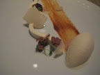 For some reason this was the only dish that I thought to snap a pic of (I forgot I had my camera with me). It's quite dark but it gives a feel for the lovely presentation of this dessert. This was another course where there a successful synthesis of disparate flavors. On its own the beer ice cream had a bit of a bitter finish, but it combined nicely with the white chocolate and malt smear.
Anyway, almost all of the courses were memorable and really delicious. I feel like my understanding of American cuisine really expanded with the exposure to new flavor profiles, techniques, and ways of thinking about food.
At J's suggestion, we opted for the 12 course tasting menu, and we were certainly not disappointed. Only the opening course, a delicious seared bonita with pistacio paste, was commonplace. Most of the other courses exhibited a culinary creativity that I don't think I've experienced before. I'm still not exactly sure what molecular gastronomy means (or whatever term they're using this week), but my impression was one of analysis and synthesis. For some courses it seemed like we were deconstructing a familiar item into its fundamental components and then reconfiguring each component slightly. In other courses, there was a focus on synthesis: disparate flavors and textures that were surprisingly complimentary when combined. The following are just a few of the courses that really stood out for me as particularly memorable:
Pizza pebbles, pepperoni, shiitake
One of the interesting things about the actual menu was how deceptively simple everything sounded on paper. In this case the "pizza pebbles" were marble-sized balls of very concentrated pizza flavor sitting on beds of something that looked like cheese (?) and accented with shiitake mushroom and fresh herbs. The only thing that didn't quite work for me was the texture of the pebbles, which seemed grainy to me. Was that on purpose (pebbles=grainy)?
Knot foie
This course was beautifully presented: a thick rectangular thread of foie gras was sculpted into a knot and then topped with tiny grains of Iranian cracker and spicy kimchee puree. Really nice.
Beef tongue, fried mayo, tomato molasses
This inventive (signature?) dish represented another decontruction, like the pizza pebbles. In this case it seemed like a hamburger decontructed, or maybe a deli sandwich, with the beef tongue cured and thinly sliced, small cubes of fried mayonnaise, a smear of "tomato molasses", and finely diced lettuce and onion to the side. Delicious.
French onion soup
This was another unique take on an old standby. The wd-50 website has a photo of this one, so scroll down and check it out.. in the broth there were these liquid "ravioli" of gruyere.. creamy on the inside but incapsulated in a kind of bubble. Apparently the technique here involves sodium alginate and calcium chloride, which are widely used in molecular gastronomy to produce these liquid bubbles. Very cool stuff.
Lamb belly, black chickpea, cherried cucumber
This was the final entree course, and it really packed a punch. The lamb belly was sliced and tasted like strongly flavored bacon and the chickpeas were purreed on the side. It hovered just on the edge of overpowering, but was tremendously satisfying before heading into the dessert courses.
Ocean trout, fava bean, forbidden rice
This one wasn't technically on the tasting menu, but they served it to R as a substitution for a shellfish course. The forbidden rice looked like hard balls of charcoal, but inside the crusty exterior they were soft and absolutely scrumptious. From the article, linked above, it says that they cook the rice, put it through a meat grinder, then fry it. Delish.
Date sorbet, pandan-soymilk, matsutake
This was the first of several dessert courses that we were treated to. The matsutake was formed into a small cylinder filled with the date sorbet. It was absolutely heavenly.
Fried butterscotch pudding, mango, taro, smoked macadamia
Another wonderful dessert, with the combination of sweet fried butterscotch and Hawaiian flavors of taro and macadamia.
Soft white chocolate, potato, malt, white beer ice cream
For some reason this was the only dish that I thought to snap a pic of (I forgot I had my camera with me). It's quite dark but it gives a feel for the lovely presentation of this dessert. This was another course where there a successful synthesis of disparate flavors. On its own the beer ice cream had a bit of a bitter finish, but it combined nicely with the white chocolate and malt smear.Anyway, almost all of the courses were memorable and really delicious. I feel like my understanding of American cuisine really expanded with the exposure to new flavor profiles, techniques, and ways of thinking about food.
Wednesday, October 24, 2007
Jersey Fall Foliage Ride (about 40 miles)
I had hoped to time my trip to New York such that I would catch the trees in full autumn bloom. But as we've learned in the past, for instance like when I tried to time my trip to Japan to hit the cherry blossom explosion, mother nature likes to fart in my general direction. So, predictably, the fall foliage was late this year due to unseasonably warm weather well into October. However, after consulting the local area foliage report, we figured we might catch the edge of the autumn wave by riding north into New Jersey. And in fact we were victorious, and saw many leaves of red, yellow, orange, etc. Take that, Nature!
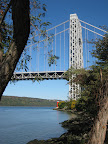 To get to New Jersey we followed the Hudson River Greenway up to the GW Bridge, which connects Manhattan with New Jersey. Even from half way across the bridge, we could start to see small patches of fall color on the Jersey side.. vibrant reds and yellows instead of the muted browns we had seen up to that point.
 Once across the bridge we headed northwest along the 9W highway, where I experimented with some action! shots-- basically trying to take some photos while riding. After several miles we turned back towards the river and followed the wonderfully scenic Henry Hudson Drive back towards the bridge.
Once we returned to the city we did a quick loop around Central Park. J said that this was a rite of passage for cyclists in NYC, and who am I to argue the point?
Animules: only the domesticated kind
Total Distance: 39 miles
Elevation Gain: 3600 feet
Route (on bikely.com): Jersey Fall Foliage with Park Loop
To get to New Jersey we followed the Hudson River Greenway up to the GW Bridge, which connects Manhattan with New Jersey. Even from half way across the bridge, we could start to see small patches of fall color on the Jersey side.. vibrant reds and yellows instead of the muted browns we had seen up to that point.Once across the bridge we headed northwest along the 9W highway, where I experimented with some action! shots-- basically trying to take some photos while riding. After several miles we turned back towards the river and followed the wonderfully scenic Henry Hudson Drive back towards the bridge. Once we returned to the city we did a quick loop around Central Park. J said that this was a rite of passage for cyclists in NYC, and who am I to argue the point?
Animules: only the domesticated kind
Total Distance: 39 miles
Elevation Gain: 3600 feet
Route (on bikely.com): Jersey Fall Foliage with Park Loop
West Side-Brooklyn Loop (about 40 miles)
This ride begins on the upper west side, follows the Hudson River Greenway downtown, then takes you over the bridge for a nice tour of Brooklyn. The Brooklyn bridge has a fairly wide pedestrian/bike lane; the ped side was packed with tourists, but there were just a few cyclists sharing the bikelane with us. Once over the bridge, the route leads through some lovely residential areas of Brooklyn, through Prospect Park, and then down Ocean Parkway to Coney Island. The main amusement park at Coney Island was closed... semi-permanently it seems. Apparently there's a controversial plan to develop the site of the Astroland park and build god knows what. Happily Nathan's is open year round, so we stopped and had dogs and fries, which really hit the spot.
After lunch we continued along the lower New York bay and picked up another waterfront multi-use path that offered up some nice views of the bay and Staten Island. Beware the headwinds!
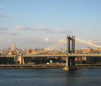
Winding our way back to the Brooklyn Bridge, we headed up Clinton St.. a beautiful tree-lined residential street full of brownstones and amazing historic churches. Heading back over the bridge in the late afternoon, the light illuminated the city skyline and the nearby Manhattan bridge.
Animules: some dead rats that I somehow missed
Total Distance: 39 miles
Elevation Gain: 1440 feet
Route (on bikely.com): West Side-Brooklyn loop
Dining Notes
For dinner we headed over to the Neptune Room, a nice little seafood bistro not far from R and J's place. I had a nice salad with arugula, roasted red peppers, and fried artichoke leaves, and an entree of lobster risotto that was rich and comforting without being heavy. For dessert we shared a devine vanilla panna cotta. Yum!
After lunch we continued along the lower New York bay and picked up another waterfront multi-use path that offered up some nice views of the bay and Staten Island. Beware the headwinds!
Winding our way back to the Brooklyn Bridge, we headed up Clinton St.. a beautiful tree-lined residential street full of brownstones and amazing historic churches. Heading back over the bridge in the late afternoon, the light illuminated the city skyline and the nearby Manhattan bridge.
Animules: some dead rats that I somehow missed
Total Distance: 39 miles
Elevation Gain: 1440 feet
Route (on bikely.com): West Side-Brooklyn loop
Dining Notes
For dinner we headed over to the Neptune Room, a nice little seafood bistro not far from R and J's place. I had a nice salad with arugula, roasted red peppers, and fried artichoke leaves, and an entree of lobster risotto that was rich and comforting without being heavy. For dessert we shared a devine vanilla panna cotta. Yum!
Tuesday, October 23, 2007
Hudson River Ramble (12 miles)
This past weekend I was in NYC visiting friends who are long-time avid cyclists, so we took advantage of the (mostly) stellar weather to ride three days in a row. Yay! I'll describe the routes-- as well as the post-ride dining and entertainment-- over the next few posts. But first I want to give a shoutout and big thank you to my buddies R and J in NYC. They were incredibly hospitable and generous while my junk and I were occupying their living room for 4 days.
A quick note about the equipment used on these rides: For this trip I rented a 7 speed hybrid from Eddie's Bicycles Shop down the street from R and J's abode on the upper west side. This shop features a friendly staff and a fleet of wobbly-wheeled, fender-rattling cross-town Fujis ($35/day). I was actually quite surprised how comfortable the bike was, considering how many miles we logged.
Anyway, the first day's afternoon forecast (or futurecast as the local weatherman described it) called for thunderstorms, so we just took a quick jaunt up the Hudson River Greenway to the base of the George Washington Bridge. The greenway is a nice multi-use path that runs right alongside the west side waterfront from Battery part to the GW bridge. The path takes a little detour at 125th street, but this affords an opportunity to cruise by the Cotton Club and Dinosaur Bar B Que before rejoining the path.
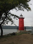 At the base of the GW bridge is a very small red lighthouse with some
interesting history and literary credentials. Honestly it seems too small to imagine that it was ever very effective. On the other hand, I didn't see any remnants of shipwrecks along the waterfront, so I guess it did alright.
Animules: domesticated urban animal life, lots of squirrels
Distance: 12 miles
Elevation: 869 feet
Route: Hudson River Ramble (bikely.com)
Dining and Entertainment Notes
On Friday night we had a lovely meal at Haru in the neighborhood. I had some particularly tasty tempura and a roll combo that left me feeling a little bit like Violet Beauregarde. Good times.
After dinner we headed down to the Village Vanguard to catch a performance by the Heath Brothers. This is a wonderfully intimate venue in a subterranean space, where you just feel the history of the place oozing out of the bricks. The Heath brothers were great-- charming, funny, clearly enjoying the jazz lifestyle.
A quick note about the equipment used on these rides: For this trip I rented a 7 speed hybrid from Eddie's Bicycles Shop down the street from R and J's abode on the upper west side. This shop features a friendly staff and a fleet of wobbly-wheeled, fender-rattling cross-town Fujis ($35/day). I was actually quite surprised how comfortable the bike was, considering how many miles we logged.
Anyway, the first day's afternoon forecast (or futurecast as the local weatherman described it) called for thunderstorms, so we just took a quick jaunt up the Hudson River Greenway to the base of the George Washington Bridge. The greenway is a nice multi-use path that runs right alongside the west side waterfront from Battery part to the GW bridge. The path takes a little detour at 125th street, but this affords an opportunity to cruise by the Cotton Club and Dinosaur Bar B Que before rejoining the path.
At the base of the GW bridge is a very small red lighthouse with some interesting history and literary credentials. Honestly it seems too small to imagine that it was ever very effective. On the other hand, I didn't see any remnants of shipwrecks along the waterfront, so I guess it did alright.
Animules: domesticated urban animal life, lots of squirrels
Distance: 12 miles
Elevation: 869 feet
Route: Hudson River Ramble (bikely.com)
Dining and Entertainment Notes
On Friday night we had a lovely meal at Haru in the neighborhood. I had some particularly tasty tempura and a roll combo that left me feeling a little bit like Violet Beauregarde. Good times.
After dinner we headed down to the Village Vanguard to catch a performance by the Heath Brothers. This is a wonderfully intimate venue in a subterranean space, where you just feel the history of the place oozing out of the bricks. The Heath brothers were great-- charming, funny, clearly enjoying the jazz lifestyle.
Sunday, October 14, 2007
Mt. Hamilton (40 miles)
One of my goals for the upcoming winter is to ride to the summit of the three bay area peaks (Mts. Diablo, Hamilton, and Tamalpais). I've made it to the ranger station junctions at Diablo and Tam, but I've never ridden Mt. Hamilton. So today I decided to give it a shot.
Mt Hamilton, located in the south bay near San Jose, is, I believe, the tallest peak in the bay area, with its various summits (there are several along the ridge) measuring in the 4200-4300 foot range. It's also probably the easiest of the three to climb, since it's gently graded most of the way. Of course the price of the gentle grade is a very long climb: from the base of Mt Hamilton Road up to Lick Observatory is 18 miles. But I much prefer a long gentle climb to a short steep one, so Hamilton was right up my alley. The first twelve miles were pretty easy, with the steady ascent broken by a couple of 1-2 mile descents. This provided a nice respite during the climb, but then later coming down it meant that I had to do a little more climbing when I was pretty pooped.
The last 6-7 miles were a bit tougher. The road leading up to the Observatory is a bit steeper than the previous 12 miles, and I had a little mini-bonk on the last few miles. I had been going at a steady pace of 6-7 mph in the first 12 miles, but had to drop down to 4-5 mph on the final ascent. I just ran out of energy, and actually felt a little nauseous when I finally made it to the Observatory. I had only consumed half a luna bar and one gel in about 3 hours of steady climbing, so I don't think I had enough calories to keep me going. But I made it, so yay!
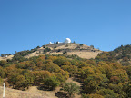 Lick Observatory is interesting.. it was built between 1876 and 1888, and has been run by the University of California since 1888 (UC has its mitts on all kinds of things that most people don't know about). According to wikipedia, the gentle grade of the road was to facilitate the transportation, by horse and mule-drawn wagons, of building materials for the observatory.
Near the end of the long descent down the mountain, I heard a pop and pulled off to the side of the road. I had broken a spoke and my back wheel was so out of true that it was rubbing against the frame. Fabulous. A couple of cyclists stopped to offer help, but none of us had a spoke wrench or knew how to true a wheel, so we just loosened everything as much as we could so I could coast the last 3 miles down the hill. The woman who stopped said that her husband ran a bike shop in Santa Cruz.. I think she said it was called Sprockets. So, a shout out to the woman from Sprockets who stopped to help. Anyway, I dropped the bike off at the shop to have the spoke fixed and the wheel trued. My two readers will remember the trouble I went through when my other bike started popping spokes left and right, so let's hope I'm not heading down that path with the Dolce as well.
Animules: horses, several deer, lots of suicidal squirrels
Total Distance: 39 miles
Time in the Saddle: 4 hours
Elevation Gain: 5900 feet
Route (on bikely.com): Mt Hamilton
Mt Hamilton, located in the south bay near San Jose, is, I believe, the tallest peak in the bay area, with its various summits (there are several along the ridge) measuring in the 4200-4300 foot range. It's also probably the easiest of the three to climb, since it's gently graded most of the way. Of course the price of the gentle grade is a very long climb: from the base of Mt Hamilton Road up to Lick Observatory is 18 miles. But I much prefer a long gentle climb to a short steep one, so Hamilton was right up my alley. The first twelve miles were pretty easy, with the steady ascent broken by a couple of 1-2 mile descents. This provided a nice respite during the climb, but then later coming down it meant that I had to do a little more climbing when I was pretty pooped.
The last 6-7 miles were a bit tougher. The road leading up to the Observatory is a bit steeper than the previous 12 miles, and I had a little mini-bonk on the last few miles. I had been going at a steady pace of 6-7 mph in the first 12 miles, but had to drop down to 4-5 mph on the final ascent. I just ran out of energy, and actually felt a little nauseous when I finally made it to the Observatory. I had only consumed half a luna bar and one gel in about 3 hours of steady climbing, so I don't think I had enough calories to keep me going. But I made it, so yay!
Lick Observatory is interesting.. it was built between 1876 and 1888, and has been run by the University of California since 1888 (UC has its mitts on all kinds of things that most people don't know about). According to wikipedia, the gentle grade of the road was to facilitate the transportation, by horse and mule-drawn wagons, of building materials for the observatory. Near the end of the long descent down the mountain, I heard a pop and pulled off to the side of the road. I had broken a spoke and my back wheel was so out of true that it was rubbing against the frame. Fabulous. A couple of cyclists stopped to offer help, but none of us had a spoke wrench or knew how to true a wheel, so we just loosened everything as much as we could so I could coast the last 3 miles down the hill. The woman who stopped said that her husband ran a bike shop in Santa Cruz.. I think she said it was called Sprockets. So, a shout out to the woman from Sprockets who stopped to help. Anyway, I dropped the bike off at the shop to have the spoke fixed and the wheel trued. My two readers will remember the trouble I went through when my other bike started popping spokes left and right, so let's hope I'm not heading down that path with the Dolce as well.
Animules: horses, several deer, lots of suicidal squirrels
Total Distance: 39 miles
Time in the Saddle: 4 hours
Elevation Gain: 5900 feet
Route (on bikely.com): Mt Hamilton
Monday, October 1, 2007
September mileage stats
My father was visiting this weekend, so I didn't get to do any riding, which kinda sucked. Still, managed to log over 400 miles in September.
September mileage: 411
September Time in the Saddle: 34.3 hours
September mileage: 411
September Time in the Saddle: 34.3 hours
Sunday, September 23, 2007
Mount Diablo Junction
Today I road up Mount Diablo, to the ranger station junction, for the first time in 2-3 years and only the second time ever. The first and last time I did this ride it was just too much for me, and I kinda figured that I would never want to do it again. But I've been doing a lot more climbing this season, so I thought I should give it another try and see if it was as bad as I remembered.
Mount Diablo is one of the three major peaks in the bay area (along with Mt Tamalpais in marin and Mt Hamilton in the south bay) and a favorite ride for lots of cyclists. There are two approaches to the ranger station, Northgate and Southgate. From the junction of that two roads, at 2200 feet, it's another 4.5 miles to the summit, which is about 3800 feet. Both times I've done this ride I've followed the Yellowjackets routesheet, which leads you up the more gently graded Southgate to the junction and then down Northgate.
Anyway, from the base of Southgate to the junction is a steady 6 mile climb. The average grade on this road is apparently 4.5%, but there are sections in the first 2 miles that are steeper. To my surprise I really didn't find the ride that difficult this time around. In fact I actually enjoyed it quite a bit, so I guess that means that I've become much better at climbing over the past couple of years. Whee! It took me pretty much exactly 1 hour to reach the junction, which isn't gonna break any records but it's pretty good for me. Next time I'll either try to improve on that time or try for the summit.
Oh, and a shoutout to the guy who helped me with my flat tire at the entrance to Southgate. I went to fix my flat and realized that the guy at the shop who installed my new cassette put my quick release on so tightly that I couldn't open it. Jerk. So thanks to the guy to stopped to helped me open it and then proceeded to fix my flat for me.
Total miles: 34
Total time in the saddle: 3 hours
Elevation gain: 2300 feet
Saturday, September 22, 2007
Calistoga Loop (52 miles)
On Thursday I left work early and drove up to Calistoga for a couple of days to relax and rejuvenate. Naturally I took along one of the bikes for a little jaunt on Friday. I ended up taking the Terry touring bike, since I figured I might be stopping at a winery along the way and would then need the use of the panniers to carry back purchases. While in Calistoga I stayed at the Indian Springs Resort, my favorite place in Calistoga. They have a huge (like Olympic size) mineral pool fed from their own geyser right next to the pool. I love it.
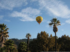 Oh, and then on Friday morning when I woke up and popped my head outside, this beautiful hot-air balloon was passing right over the resort. Ah, wine country...
The ride, called the "Reverse Calistoga" loop, is from the Oakland Yellowjackets routesheet library. My total mileage was 6-7 miles higher since my starting point was in downtown Calistoga. The route is pretty straightforward: you follow Silverado Trail a couple of miles, then turn east for a bit of a climb up Deer Park/Howell Mountain road, then take Ink Grade to Chiles Pope Valley to Lake Hennessey. Then it's back up Silverado Trail. There was a steady climb up Deer Park/Howell Mountain, but it wasn't too bad, topping out at around 1800 feet before I turned onto Ink Grade. Ink Grade is a well-known climb in the north bay (it's featured in most of the centuries in the napa area) so I was expecting some pretty harsh climbing at this point. But it turns out that this route approached Ink Grade from the other end so all I had to do was descend. Maybe that's why they call this route the "reverse" Calistoga. Whatever. I was quite happy to be plunging down this grade rather than slogging up it.
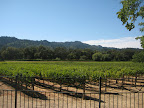 The rest of the ride was really nice. The route takes you through vineyards and farmland, by the incredibly dry Lake Hennessey, and through two villages, Angwin and Pope Valley. Not many services to be had in this back country, so I was glad to have my panniers with plenty of food and water.
Animules: 2 foxes (I think), several deer, many lazy cows
Total Miles: 52
Elevation Gain: 3900 ft
Route map (bikely.com): Calistoga Loop
Wine Notes
As long as I'm up in wine country, it seems stupid to not do a little bit of winetasting, right? So on Friday, right after finishing up the ride, I headed over to Vincent Arroyo. I've been meaning to visit this place for quite some time. It's off the beaten path a bit, but I had heard that they had very good wines and that they sell out of their small production early in the season. Turns out that you're supposed to have an appointment for tasting, but Dave, my host, graciously signed me up for an impromptu appointment. I thought I was pretty special to receive this treatment until I saw them do the same for other walk-ins. Apparently they aren't zoned for a public tasting room, but they are happy to accommodate a small number of walk-ins.
Vincent Arroyo produces only about 8000 cases a year, and most of that is sold on pre-order before it's even bottled. I bought a bottle of their 2006 Chardonnay, which is lightly oaky with a bit of citrus, and a 2005 Petite Syrah, their signature wine. I also tried the 2005 Melange reserve (a gamay blend) and the 2005 Entrada, a blend of old vine Syrah, Petite Syrah, and Cabernet. It was a very elegant wine with a smooth finish, but at $65 a bottle, a little more than I wanted to pay.
On Saturday, on my way back to town, I stopped in at Heitz Cellars, just outside of St Helena on highway 29. Heitz is known for their Cabernet Sauvignons, particularly the Oakville "Martha's Vineyard" label. After trying their 2005 Chardonnay and a Verdot, I tasted the 2002 "Trailside Vineyard" Cab, then the 1998 Bella Oaks Cab. I actually preferred the latter because it had a lovely smooth finish, but that's probably due in part to the fact that it was 1998, right? Next I sampled three ports-- the Ink Grade port, the "vintage" Ink Grade port, and the Grignolino ruby port, that has an interesting citrus aroma that I don't think I've run across in ports. After all this, the host poured me a bit of their signature Martha's Vineyard cab, but my palette was pretty overloaded at that point. I'm sure it was delicious though. So, I ended up buying two bottles of the Chardonnay, one bottle of the Verdot, and one bottle of each of the ports. Yeehah!
Oh, and then on Friday morning when I woke up and popped my head outside, this beautiful hot-air balloon was passing right over the resort. Ah, wine country...The ride, called the "Reverse Calistoga" loop, is from the Oakland Yellowjackets routesheet library. My total mileage was 6-7 miles higher since my starting point was in downtown Calistoga. The route is pretty straightforward: you follow Silverado Trail a couple of miles, then turn east for a bit of a climb up Deer Park/Howell Mountain road, then take Ink Grade to Chiles Pope Valley to Lake Hennessey. Then it's back up Silverado Trail. There was a steady climb up Deer Park/Howell Mountain, but it wasn't too bad, topping out at around 1800 feet before I turned onto Ink Grade. Ink Grade is a well-known climb in the north bay (it's featured in most of the centuries in the napa area) so I was expecting some pretty harsh climbing at this point. But it turns out that this route approached Ink Grade from the other end so all I had to do was descend. Maybe that's why they call this route the "reverse" Calistoga. Whatever. I was quite happy to be plunging down this grade rather than slogging up it.
The rest of the ride was really nice. The route takes you through vineyards and farmland, by the incredibly dry Lake Hennessey, and through two villages, Angwin and Pope Valley. Not many services to be had in this back country, so I was glad to have my panniers with plenty of food and water.Animules: 2 foxes (I think), several deer, many lazy cows
Total Miles: 52
Elevation Gain: 3900 ft
Route map (bikely.com): Calistoga Loop
Wine Notes
As long as I'm up in wine country, it seems stupid to not do a little bit of winetasting, right? So on Friday, right after finishing up the ride, I headed over to Vincent Arroyo. I've been meaning to visit this place for quite some time. It's off the beaten path a bit, but I had heard that they had very good wines and that they sell out of their small production early in the season. Turns out that you're supposed to have an appointment for tasting, but Dave, my host, graciously signed me up for an impromptu appointment. I thought I was pretty special to receive this treatment until I saw them do the same for other walk-ins. Apparently they aren't zoned for a public tasting room, but they are happy to accommodate a small number of walk-ins.
Vincent Arroyo produces only about 8000 cases a year, and most of that is sold on pre-order before it's even bottled. I bought a bottle of their 2006 Chardonnay, which is lightly oaky with a bit of citrus, and a 2005 Petite Syrah, their signature wine. I also tried the 2005 Melange reserve (a gamay blend) and the 2005 Entrada, a blend of old vine Syrah, Petite Syrah, and Cabernet. It was a very elegant wine with a smooth finish, but at $65 a bottle, a little more than I wanted to pay.
On Saturday, on my way back to town, I stopped in at Heitz Cellars, just outside of St Helena on highway 29. Heitz is known for their Cabernet Sauvignons, particularly the Oakville "Martha's Vineyard" label. After trying their 2005 Chardonnay and a Verdot, I tasted the 2002 "Trailside Vineyard" Cab, then the 1998 Bella Oaks Cab. I actually preferred the latter because it had a lovely smooth finish, but that's probably due in part to the fact that it was 1998, right? Next I sampled three ports-- the Ink Grade port, the "vintage" Ink Grade port, and the Grignolino ruby port, that has an interesting citrus aroma that I don't think I've run across in ports. After all this, the host poured me a bit of their signature Martha's Vineyard cab, but my palette was pretty overloaded at that point. I'm sure it was delicious though. So, I ended up buying two bottles of the Chardonnay, one bottle of the Verdot, and one bottle of each of the ports. Yeehah!
Sunday, September 16, 2007
Orinda-Palomares
Today I did the Orinda-Palomares ride again, for the first time since early June. This is one of my favorite rides in the east bay, but it's really a spring or fall ride (it's a bit too warm in the summer for it). I got a chance to try out my new cassette on the climb up Palomares Road, and I was pleased that the additional granny gear on the new cassette really made a difference on the steep sections. I used to wish I had just one lower gear on some of these climbs, and now I do! Whee!
Animules: lots of deer on Palomares Road
Distance: 58 miles
Elevation gain: 2300 feet
Time in the Saddle: 4.5 hours
Route: Orinda-Palomares (bikely.com)
Animules: lots of deer on Palomares Road
Distance: 58 miles
Elevation gain: 2300 feet
Time in the Saddle: 4.5 hours
Route: Orinda-Palomares (bikely.com)
Sunday, September 9, 2007
new cassette and then some
I mentioned a couple of weeks ago that I had ordered a new 28-11 8-speed cassette for the Dolce. It finally came in this week, but after the shop installed it, the mechanic noticed that the pulley of the rear derailleur was rubbing against the lowest gear. Turns out that rear derailleurs are designed for a maximum size rear sprocket, and if you exceed this max size by too much, the jockey pulley rubs against the low gear sprocket. Who knew?
My options were: put the old 25-12 cassette back on or keep the new cassette and buy a new, better derailleur. So now I have a new cassette and a new Ultegra GS rear derailleur. Woohoo!
My options were: put the old 25-12 cassette back on or keep the new cassette and buy a new, better derailleur. So now I have a new cassette and a new Ultegra GS rear derailleur. Woohoo!
Dumbarton-Palo Alto ride
Last weekend on my Half Bay in a Day route, I rode over two of the three major bay area bridges that are open to cyclists ( the Golden Gate and the new Carquinez). So today I decided to traverse the third, the Dumbarton bridge, which is the southern-most bridge that crosses the bay, linking Fremont on the east bay with Palo Alto on the peninsula. I followed the Oakland Yellowjackets' routesheet (pdf), but I started at a different BART station to tack on a few extra miles.
Overall, this is a relatively uninspiring ride. It takes you through some nice parts of Palo Alto, Portola, and Woodside on the peninsula (ground I've covered on several other peninsula rides), but the bridge itself isn't all that interesting, and frankly, the areas surrounding the bridge smell really bad. The one area that was a bit interesting was the marshlands on the Fremont side of the bridge. This is the second weekend in a row that I've stumbled upon some interesting bay area marshlands that I had no idea even existed. I probably don't associate the bay area with wetlands because San Francisco and the east bay shoreline have filled them all in. Anything that was swamp back in the 19th century is now land-fill, of course. I've been reading on the internets that 85% of the bay area's original marshes and shorelines have been altered in the last 150 years. But it seems that there are these pockets around the bay-- in Marin, in the north San Pablo bay area, and in this area of Fremont-- where agencies have attempted to preserve and restore the natural shoreline habitats.
This one is called the Don Edwards San Francisco Bay WIldlife Refuge. This was the first urban National Wildlife refuge in the U.S., and it covers 30,000 acres of bay, salt ponds, marsh, etc. They have a beautiful visitors center and several nature hike trails, so I definitely plan on returning there when I have a bit more time to explore.
But enough of the positive, let's talk about the negative! Maybe it's my long biking season wearing me down, and/or the 3200 miles I've puts on the bikes since January, but I've developed some pet peeves that really prevent me from fully enjoying a ride. All three were present on the Dumbarton ride:
1. Poor road quality. I swear there are maybe 5 roads in the entire bay area that are not collections of poorly patched potholes, tree root cracks, earthquake fissures, and small boulders. Is this a conspiracy to make us all buy expensive carbon frame bikes? I actually have things fall off of my bikes because of the poor quality of the roads. Oh well, I guess I didn't need that rear reflector anyhow.
2. Headwinds. Seriously, it is possible to have headwinds in every direction during a single ride? Wtf?
3. Shards of glass in the bike lane, covering the entire width of the bike lane, just for good measure. I know we all love the smashy-smashy, but can we be a little less ghetto in the ghetto?
Speaking of ghetto, I parked my car at the Fruitvale BART station and when I got back in the afternoon I noticed that the lock on my driver's side door was a bit wonky, and there were papers and junk strewn about the passenger seat. So, somebody broke into my car (by opening my incredibly secure door lock), went rummaging through my glove box, map slots, ash tray (?), but didn't take anything. I don't keep anything of real value in the car because people keep fucking breaking into it, but I did have my stereo face and several CDs in one of the compartments and they were left untouched. Either they didn't look in there or they don't like my taste in music. But who doesn't love Lynyrd Skynyrd?!
Apparently my model of Toyota has the world's easiest locks to pop open. I wouldn't really mind them taking a peek inside, but their handiwork is really screwing up the lock mechanisms on the doors. At this point the passenger side door lock is completely busted, and now the driver's side is getting pretty bad. Thanks a lot hoodlums.
Total Miles: 60
Time in the saddle: 5 hours
Elevation gain: 1100 feet
Sunday, September 2, 2007
Half Bay in a Day
Last week I had a brilliant idea: to circumnavigate the San Francisco bay over the course of 2 days. I would start in San Francisco and travel clockwise, passing through Marin and the North Bay on the first day, then begin day two in Oakland and travel through the east bay, across the Dumbarton bridge, and up the peninsula to finish in SF. That was the plan. I ended up completing the first leg, from SF to Oakland, but then lost my motivation for the second day. Which is why this entry is called "Half Bay in a Day" rather than "Bay in 2 Days".
I've mentioned elsewhere that there's a plan to eventually encircle the bay with a multi-use path called the Bay Trail. Right now there are huge gaps in the trail and some sections are unpaved, so until it's completed, you have to piece together a route around the bay based on the existing network of paths, bike lanes, designated bike routes, highways, etc. While there were some interesting sections of the ride, like the north bay marshlands and traveling over the new span of the Carquinez bridge, overall it wasn't that pleasurable. I think I'll wait until the Bay Trail is complete before trying it again.
The route begins at the Ferry Building in San Francisco, and follows the well-traveled route along the waterfront, over the Golden Gate bridge, through Sausalito, Corte Madera, San Rafael, and Novato. This stretch of the route through Marin (about the first 35 miles or so) was very pleasant, although once you get through Sausalito, the bay is out of sight for quite a while. I could have followed a different route closer to the water, one that goes by San Quentin, but that's not all that pleasant. Side note: isn't it strange how, in the bay area, the maximum security prisons occupy great waterfront property? They could move San Quentin to Bakersfield and convert that land to expensive condos in a flash.
At around mile 40 the route joins Highway 37, which is the only way to get from Novato to Vallejo and is, I believe, technically a "freeway" in certain spots. I really don't enjoy riding on the shoulder of freeways for 15 miles, with cars and tanker trucks zipping by at 65+. However, this highway does have a nice generous shoulder the entire stretch, with those safety bumps providing an extra buffer between you and the cars. It wasn't an ideal cycling road, but it's kind of the only option if you want to get from point A to point B in this part of the bay. So I just plugged in the iPod, put my head down, and tried to blast through this stretch as quickly as possible.
The terrain right along the water in the north bay is unspectacular, but vaguely interesting: it's all salt water marsh where the Petaluma River, Tolay Creek, and Sonoma Creek all enter the bay. Apparently this is area is called the Napa-Sonoma Marsh, and represents a prime example of tidal wetlands. There are several spots along the highway where you can pull off and find trailheads and wildlife viewing spots. So that was kind of interesting. Also, everytime I'm around marshes I think of that X-Files episode with Luke Wilson, where Mulder asks if there are any swamps in the area, and the Sheriff says "We used to have swamps, only the EPA made us take to calling 'em wetlands." Heh.
Past the wetlands, the route takes you through a ghetto-y part of Vallejo to the new Carquinez bridge span, the Alfred Zampa Memorial Span. Go Afred, you got your own bridge! The new span has a lovely bike-pedestrian lane along the western side of the bridge, joining the Golden Gate and the Dumbarton as the select bridges in the bay area with bicycle access. I'm looking at you, Bay Bridge...
The Carquinez bridge dumps you into Crockett, from where you take a lovely little tour past the ConocoPhillips oil refinery. Nasty! After that, the last 10 miles wind through east bay suburbs (Rodeo, Hercules, El Sobrante, etc.) back to sweet, sweet home Oaktown.
Total Miles: 80
Time in the saddle: 7.3 hours
Elevation gain: 3400 feet
route: SF-Oakland via north bay
Friday, August 31, 2007
August mileage stats
August was good. Thanks to the ride down the coast, I logged over 500 miles in the month, a first ever.
August mileage: 516
August Time in the Saddle: 47 hours
August mileage: 516
August Time in the Saddle: 47 hours
Sunday, August 26, 2007
East Bay Trails (CFGFC lite)
This weekend I decided to do a shorter, modified version of the CFGFC route, for two reasons: a) I wanted to proof the route to make sure nothing had changed since last year (construction, road closures, etc.) and b) I wanted to try some different routes for the last 30 miles between Fremont and Oakland.
Basically the first 70 miles of the CFGFC are great. You've got the Oakland hills, the San Ramon Valley, a few nice multi-use trails, good road conditions, and nice scenery. The problem is the final leg between Fremont and Oakland, or at least the stretch between Fremont and San Leandro. It's basically a wasteland of industrial parkways, ghettos, and barrios, sprinkled with the occasional stripmall. It's a bit depressing, if not dangerous in some spots. So, each year I hit the road in search of a better route. I like to think of it as my own search for a Northwest Passage. Anyway, today's effort was not wholly successful, but I did find some new and interesting multi-use trails that I'll probably incorporate into the CFGFC. So we'll call this ride the East Bay Trail Excursion.
This ride began at Orinda BART station, traveled south through San Ramon valley, west through Niles Canyon, and then north more or less along the bay to end at Fruitvale BART. Notable trails used on the ride include:
Lafayette Moraga Trail and Iron Horse Trail: my two readers will recognize these trails from previous rides. Both are well graded, scenic, and high quality.
Alameda Creek Trail: This trail runs alongside the Alameda Creek, from Niles Canyon all the way to the bay. The trail along the southern bank is paved for cyclists and what have you; the trail along the northern bank is dirt and gravel for horses and people who like dirt. It's not as pretty as the Iron Horse or the other trails in the San Ramon valley, but it's pretty nice for Fremont and Union City.
Union City Trail: This is a strange, hidden little multi-use trail I stumbled upon in Union City. This one is deep undercover people: there aren't even any websites that describe it. Think on that. The good part about it is that it's not busy at all (in fact it was empty). The bad part is that it might be abandoned? I couldn't tell. There seemed to be a lot of obstacles to actually using the trail, like closed gates and a section with open, raised railroad tracks, so I'm wondering if this trail is officially in use. It was a bit creepy.. I had a thought that someone could disappear on this trail and no one would ever know. So, it's definitely going into the CFGFC route.
Bay Trail from San Leandro to Marina Park: This is part of the "Bay Trail" that will someday (!) encircle the entire bay with over 400 miles of continuous multi-use trails. Won't that be awesome?! It will totally solve my northwest passage issue. But until it's completed (date unknown), we have to make due with these small pieces of the trail. This one runs just a few miles right along the bay in San Leandro. The water is so close here, just a small global warming hiccup would easily flood the path. The headwinds are a bitch traveling north along the water, but the scenery is worth it.
Distance: 75 miles
Time in the Saddle: about 6.5 hours
Elevation Gain: 1370 feet
Route: East bay trails
Monday, August 20, 2007
cfgfc 2007 logo
I've been working on the logo for the 2007 cfg fall century.. here's what I have so far:


Gear ratios
For most of June and July I spent a lot of my saddle time on the Terry touring bike, in preparation for the coastal ride. The Terry has mountain-bike gearing more or less: a standard triple up front (52-42-30) with a 9 speed 11-32t cassette in back. So with the 30-32 combination, you have a decent granny gear to get you up most hills.
This weekend I took the Dolce out for the Holstein Hundred, and I had completely forgotten how different the gear ratios are on this bike. I definitely felt it on every climb. When I got back home I started counting, and soon realized that, although the triple in front is the same, the Dolce has a 12-25 cassette as opposed to the 11-32 on the Terry. Huge difference! So on Sunday I took a quick trip over to Alameda Bicycle and ordered a new 11-28 cassette. This will give me the same gears on the Specialized that I have on the Terry, with the exception of that lowest granny gear (the 32). I can't wait to get it installed and try it out on the nearest hill.
This weekend I took the Dolce out for the Holstein Hundred, and I had completely forgotten how different the gear ratios are on this bike. I definitely felt it on every climb. When I got back home I started counting, and soon realized that, although the triple in front is the same, the Dolce has a 12-25 cassette as opposed to the 11-32 on the Terry. Huge difference! So on Sunday I took a quick trip over to Alameda Bicycle and ordered a new 11-28 cassette. This will give me the same gears on the Specialized that I have on the Terry, with the exception of that lowest granny gear (the 32). I can't wait to get it installed and try it out on the nearest hill.
Saturday, August 18, 2007
Holstein Hundred, more or less
Today was the 14th annual Holstein Hundred century, which begins and ends in the tiny town of Tamales and does a couple of strangely-designed loops through Bodega Bay, Occidental, Valley Ford, and the general countryside around Petaluma. I had planned on doing the full century, but in the end I only did a metric. Not their metric, but a metric nonetheless. There are many reasons for this, but mostly I think it's the ride organizers' fault for giving me an easy out.
I woke up at 5am to drive up to Tamales, got there by 6:30, and was on the road by 7. One thing we lucked out on was the weather: it was sunny and clear, no marine layer at all. This was especially nice when we got out to the coast near Bodega Bay (where Hitchcock filmed The Birds if you didn't know). It's always nice to actually see the ocean when you're riding on the coast, as opposed to peering into a deep fog bank. Things were going quite nicely through the first 20 miles or so, until we turned inland again and began a climb up Coleman Valley Road.
I've never climbed this road before, and come to think of it, I didn't really climb it this time because I had to walk my bike up half of it. It's only about 1200 feet or so, but it's steep almost the entire way. Someone on the internets claimed that the grade was 9.5%, which is about 5% more grade than I generally enjoy. This climb was featured in one of the Tour of California stages, and it does afford some lovely views which I was able to appreciate during my long walk up to the summit.
Once we got passed this climb, the route mellowed out a bit and took us through parts of Occidental and Valley Ford that I had traversed on my Petaluma ride back in May. At this point I ended up latching on to some women from Livermore who had a little paceline going. I pulled for a while and they invited me to ride with them, but honestly their pace ended up being too much for me. They were going about 25 mph, and I just couldn't sustain that, even hooked on to the back.
At about mile 45 we turned west and that's when the headwinds began. Those lasted for about 10 miles until the route took us east again, past the starting point at Tamales High. I mentioned the strange loops that comprised the route.. basically we did a big figure eight, then passed by the starting point before beginning another loop to the south. Earlier in the morning I had thought, I can stop by my car to deposit my arm warmers, leg warmers, etc. But then after all the climbing and headwinds, and with the knowledge that another 40 miles and 3500 feet of climbing lay ahead, I was thinking, I can stop by my car, have some lunch, and call it a day! You see how this is really the organizers' fault? Because let me tell you, I wasn't the only one who had this thought. At any rate, I actually continued on a few miles passed the high school, spotted the next climb, and then backtracked to the start. So, I ended up with about 65 miles total. I'm sure I could have finished the course, but I don't think I would have enjoyed it. And as one of the volunteers said at the post-ride lunch, It's supposed to be fun, not torture.
Miles: 65
Time in the saddle: about 5 hours
Route for the Holstein Hundred: portion done and portion not done
Friday, August 10, 2007
SF-SLO Tour, Day 5
Day 5: San Simeon to San Luis Obispo(route), 43 miles
Total time in the saddle: 4 hours 15 minutes
Elevation gain: 1800 feet
After the challenges of day 4, the relatively short, flat route of the final day was a welcome sight. And although it wasn't as scenic as the previous days along the coastal cliffs, there was still plenty of interesting scenery. Just a few miles outside of San Simeon, we traveled through a cute little beach village called Moonstone Beach and then through Cambria. Past Cambria the route took us a bit inland for the next 10 miles or so, and we didn't see the ocean again until Cayucos, another cute beach town.
A few miles down the coast we stopped for lunch at Morro Bay. I had been feeling sluggish and dehydrated in the morning, but felt revived after lunch. In contrast, kc had been feeling pretty good up until Morro Bay, but then he ended up seriously bonking the final 15 miles to San Luis Obispo.
Once we arrived in SLO, kc crashed out for a few hours while I explored the quaint downtown area. Later that evening, while investigating dinner options, we ended up stumbling upon this wall downtown covered in bubble gum. Disgusting!
For my part, it was a great end to a great tour down the coast. I only wish I had been able to continue a few more days down to Santa Barbara, but alas I had to return to work. Next year I think I'll be ready for something even more challenging.
Thursday, August 9, 2007
SF-SLO Tour, Day 4
Day 4: Big Sur to San Simeon (route), 67 miles
Total time in the saddle: 7 hours
Elevation gain: 6500 feet
At 67 miles with plenty of steep climbing, we knew that the stage from Big Sur to San Simeon was going to be a "long hard day", to quote from my Lonely Planet west coast cycling book. A part of me was looking forward to the challenge, while I think all of kc was dreading the pain it would entail.
Side note: my boss' boss' boss, a hard core cyclist, maintains that you have to be a bit of a masochist to love cycling. I suppose this is true, but I don't think that kc has reached the point where he has embraced the pain.
Anyway, because we had our printed cue sheets and elevation profiles with us, we knew that right out of the gate we'd have a climb up to 1000 ft. kc decided to leave Big Sur a bit earlier and walk up that first climb, in order to conserve his energy. I would leave a bit later and meet him 7 miles south of Big Sur, at the "cafe" at Coast Gallery. I was checked out of the campgrounds and on the machine by 8:45, and while the climb was a bit steep in places, it was manageable. At Coast Gallery I found kc waiting for me but still sans coffee. Turns out the cafe noted in my guide book had closed two years back. Oops.
Between Coast Gallery and Lucia, the next stop with services (mile 25), there was nothing but coastline and constant ups and downs. Along the way we did stop at McWay falls, which is the only waterfall in California that falls directly into the ocean (or beach at low tide, apparently). Kc noted that it was like the "Earth is pissing".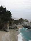
We stopped at Lucia, which is little more than a very expensive restaurant and general store along the highway, but it's pretty much the only stop along a 25 mile stretch, so there were plenty of tourists also taking a break there. We got drinks and ate the last of our soggy 2 day old PB&J sandwiches we had made in Monterey (blech), and met a couple of folks also touring along highway 1. They were heading back home to Redondo Beach, but were going to stop and camp just a few miles up the road.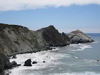
After Lucia, it was more rolling hills until we reach the next village on the highway, Gorda. Like Lucia, Gorda is basically just a restaurant, cafe, and general store, but it has a little more character than Lucia, and we spent about 45 minutes just relaxing and chatting with some of the characters hanging out there, and contemplating the two climbs we had to look forward to.
Besides the initial climb of the day and the undulations of miles 5-35, there were two principal climbs between miles 40-45. Lonely Planet classified one as "moderate" and the other as "steep", and early in the day kc had taken to calling them los cuernos del diablo (the devil's horns). After a quick descent south of Gorda, the climbing began. We conquered the first cuerno, took a breather, and then took on the much steeper second peak and conquered that one as well. Victory! After that it was screaming descent past Ragged Point, then onto flatter terrain outside of San Simeon. We arrived at the motel at 6:40pm, 10 hours after I had left Big Sur. Good times!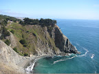
Wednesday, August 8, 2007
SF-SLO Tour, Day 3
Day 3: Monterey to Big Sur (route), 40 miles
Total time in the saddle: 4 hours
Elevation gain: 4900 feet
We got a fairly early start on Day 3, and were on the bikes by 9:30. Just south of Monterey, we cruised along the 17 mile scenic drive, which was picturesque but a bit dismal with the heavy marine layer.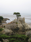
We had quick pitstops at both Carmel and Carmel Highlands, where we loaded up on supplies at the Carmel Highlands General Store. Outside the store I chatted with a woman (a Carmel Highlands firefighter?) about the 500 mile AIDS ride down the coast. She had done the ride the previous two years and was trying to talk me into it, but the mileage sounded excruciating: 80-90 miles each day. Crazy.
The next 10 miles were classic rugged coastline, with highway 1 winding up and down, hugging the cliffs. In places there was little to no shoulder and quite a bit of traffic, so that was a bit sketchy. Still, it was beautiful ride, and a taste of what was to come on day 4.
The last 10 miles or so took us inland a bit, through pastures and grazing cows, until we started climbing gently into the redwood forests of Big Sur. There we had reserved a tent cabin at Big Sur Campground and Cabins.
It was rustic but clean and blessedly free of mosquitos. After a quick survey of the handful of restaurants along the highway, we settled on the Maiden Pub in Big Sur Village. This turned out to be my favorite restaurant of the whole trip.. I highly recommend the burgers there. Deelish.
SF-SLO Tour, Day 2
Day 2: Santa Cruz to Monterey (route), 48.2 miles
Total time in the saddle: 4.5 hours
Elevation gain: 1800 feet
The morning of Day 2 began with a quick trip to the drug store to pick up the items we needed to recover from Day 1. For me that meant super power sunscreen and a bandana; for kc it was ace bandages, muscle ointments, and generally things that smelled like menthol.
South of Santa Cruz, Highway 1 is a semi-freeway with bicycle traffic prohibited, so the route took us along side streets through the outskirts of town and out through rural agricultural land. Although we were probably never further than a mile or two away from the coastline, we didn't see the ocean for most of the day. Instead we traveled along side fragrant strawberry fields, patches of lettuce and other veggies, and the like.
While stopping for sandwiches and coffee in the village of Marina we ran into a gaggle of small town cheerleaders. It took the barista 15 minutes to make my single espresso because every one of those cheerleaders had ordered a double half-caff carmel mochiatto frappucino, or something similar. Terrifying.
A few miles north of Monterey, we picked up a nice multi-use trail that led us back to the coastline. This part of the coast was dominated by huge sand dunes and the ubiquitous Monterey cypress.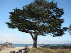
We arrived at the Monterey hostel a little after 5 o'clock. The hostel is more traditional than the Carmelita cottages in Santa Cruz, but the facility was super clean and the location couldn't be beat. We were just blocks away from Cannery Row, so we strolled down to the waterfront for dinner at a pub called Bullwacker's. I believe that everything we ate at that place was deep-fried. It tasted pretty good, but didn't sit too well with either of us that night.
Tuesday, August 7, 2007
SF-SLO Tour, Day 1
The mission: to bicycle from San Francisco (okay, Half Moon Bay) to San Luis Obispo; 250 miles in 5 days. Along the way we would experience ups and downs, cold marine layers and glorious sunshine, small town coffee, and questionable fish and chips. But we made it! Read on to see how the journey unfolded...
Day 1: Half Moon Bay to Santa Cruz (route), 50 miles
Total time in the saddle: 4.5 hours
Elevation gain: 2400 feet
Getting there: From the beginning I knew that I wanted to start the first day a bit outside of San Francisco, both to reduce the mileage a bit and to avoid the particulary sketchy stretches of highway 1 around Devil's Slide (south of Pacifica). So after waking up early to catch BART into the city, I met up with kc and took Caltrain down the peninsula to Hillsdale. Caltrain is well-equipped to handle bicycles, so it's a great choice for cyclists. At Hillsdale, we loaded the bikes onto the SamTrans bus (route 294) and headed to Half Moon Bay. Naturally, a car accident slowed traffic on highway 92 to a crawl, so we didn't actually start riding until 11:30.
By the time we hit the road, the morning marine layer had cleared and we had fabulous weather the entire way to Santa Cruz. Along the way we stopped at several state beaches, including San Gregorio and Pebble Beach. This isn't the Pebble Beach famous for golf (that's later on day 3) but rather a small beach near Pescadero that features interesting rock formations and abundant tide pools.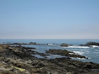
After stopping at the roadside Gazo's Grill for lunch, we took some time to explore the terrain around Pigeon Point Lighthouse. Then it was on through Davenport to Santa Cruz. Outside of town we picked up a nice multi-use trail that took us by Natural Bridges park, which didn't really look like a natural bridge from our angle. Weird.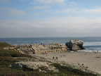
In Santa Cruz we had reserved a private room at the Carmelita Cottages hostel. This was my first foray into hostel accommodations, and I must say that I was impressed. The cottages were really quaint, perfectly situated within walking distance of both downtown and the boardwalk, and sharing a bathroom with a French (Swiss?) couple wasn't really all that bad.
We trolled the downtown stretch for a while before settling on Saturn Cafe for dinner. Although the window advertised "Burgers, Fries" etc. it turned out that the place was strictly vegetarian and vegan. I would say that their window advertising and menu really bury the lede on that, but the food was pretty decent all the same. After dinner we strolled down to the Santa Cruz Beach boardwalk and rode the "Tsunami" ride. A pretty good first day on the road.
Day 1: Half Moon Bay to Santa Cruz (route), 50 miles
Total time in the saddle: 4.5 hours
Elevation gain: 2400 feet
Getting there: From the beginning I knew that I wanted to start the first day a bit outside of San Francisco, both to reduce the mileage a bit and to avoid the particulary sketchy stretches of highway 1 around Devil's Slide (south of Pacifica). So after waking up early to catch BART into the city, I met up with kc and took Caltrain down the peninsula to Hillsdale. Caltrain is well-equipped to handle bicycles, so it's a great choice for cyclists. At Hillsdale, we loaded the bikes onto the SamTrans bus (route 294) and headed to Half Moon Bay. Naturally, a car accident slowed traffic on highway 92 to a crawl, so we didn't actually start riding until 11:30.
By the time we hit the road, the morning marine layer had cleared and we had fabulous weather the entire way to Santa Cruz. Along the way we stopped at several state beaches, including San Gregorio and Pebble Beach. This isn't the Pebble Beach famous for golf (that's later on day 3) but rather a small beach near Pescadero that features interesting rock formations and abundant tide pools.
After stopping at the roadside Gazo's Grill for lunch, we took some time to explore the terrain around Pigeon Point Lighthouse. Then it was on through Davenport to Santa Cruz. Outside of town we picked up a nice multi-use trail that took us by Natural Bridges park, which didn't really look like a natural bridge from our angle. Weird.
In Santa Cruz we had reserved a private room at the Carmelita Cottages hostel.
This was my first foray into hostel accommodations, and I must say that I was impressed. The cottages were really quaint, perfectly situated within walking distance of both downtown and the boardwalk, and sharing a bathroom with a French (Swiss?) couple wasn't really all that bad. We trolled the downtown stretch for a while before settling on Saturn Cafe for dinner. Although the window advertised "Burgers, Fries" etc. it turned out that the place was strictly vegetarian and vegan. I would say that their window advertising and menu really bury the lede on that, but the food was pretty decent all the same. After dinner we strolled down to the Santa Cruz Beach boardwalk and rode the "Tsunami" ride. A pretty good first day on the road.
Thursday, August 2, 2007
Sunday, July 29, 2007
Danville Railroad Loop (45 miles)
I woke up on Saturday feeling a bit lethargic, so I decided to just do an easy ride over to Danville and then take BART home from Lafayette. This ride is flat for the most part, with the only significant hill coming at the beginning, with the climb up Spruce Ave. into Tilden park.
From Moraga to Danville there are multi-use trails that parallel the roads. I usually stick to the road to avoid the crowded trails, but the heat on Saturday must have kept the pedestrians and joggers away. Both the Lafayette/Moraga trail and the Iron Horse trail were practically empty.
Distance: about 45 miles
Elevation gain: 2800 feet
Time in the saddle: 4 hours
Route map:
Sunday, July 22, 2007
Woodside via Canada Road (50 miles)
This morning I drove over to Burlingame on the Peninsula to do a 50 mile ride from the Velogirl's library, called "Woodside via Canada with Alpine/Edgewood loop". The peninsula isn't really my favorite riding locale, but they do have lots of rolling hills, which I thought would be good practice for the upcoming coastal ride.
The ride starts and ends in downtown Burlingame, which is actually quite quaint. Who knew? It then retraces some of the same roads as the Giro di Peninsula metric, but avoids the biggish climb up Page Mill.
Canada Road (miles 8-15) is closed to car traffic on Sundays. It's great to have the whole road reserved for cyclists, runners, and rollerbladers. A couple of miles down Canada I spotted a Greek temple out of the corner of my eye.
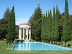
Naturally I stopped to investigate and it turns out that this is the Pulgas Water Temple, built in the '30s to celebrate the terminus of the Hetch Hetchy aquaduct that brings water from the Sierras to the bay area. Until 2004, water flowed through this temple into the Crystal Springs reservoir.
Further on, the route takes a little detour through historic Woodside and passes by the Woodside Store, a restored 19th century building once used by a Dr. Tripp.
According to the historical marker, the store was "built in 1854 among sawmills and redwood groves by Dr. R. O. Tripp and M. A. Parkhurst: operated by Dr. Tripp in person (who also served as dentist, librarian, postmaster, and community leader) until his death in 1909."
Animules: lots of horses
Distance: 50 miles
Time in the Saddle: 4 hours 45 minutes
Elevation Gain: 2850 ft
Route map: Woodside via Canada
The ride starts and ends in downtown Burlingame, which is actually quite quaint. Who knew? It then retraces some of the same roads as the Giro di Peninsula metric, but avoids the biggish climb up Page Mill.
Canada Road (miles 8-15) is closed to car traffic on Sundays. It's great to have the whole road reserved for cyclists, runners, and rollerbladers. A couple of miles down Canada I spotted a Greek temple out of the corner of my eye.
Naturally I stopped to investigate and it turns out that this is the Pulgas Water Temple, built in the '30s to celebrate the terminus of the Hetch Hetchy aquaduct that brings water from the Sierras to the bay area. Until 2004, water flowed through this temple into the Crystal Springs reservoir.
Further on, the route takes a little detour through historic Woodside and passes by the Woodside Store, a restored 19th century building once used by a Dr. Tripp.
According to the historical marker, the store was "built in 1854 among sawmills and redwood groves by Dr. R. O. Tripp and M. A. Parkhurst: operated by Dr. Tripp in person (who also served as dentist, librarian, postmaster, and community leader) until his death in 1909."
Animules: lots of horses
Distance: 50 miles
Time in the Saddle: 4 hours 45 minutes
Elevation Gain: 2850 ft
Route map: Woodside via Canada
Sunday, July 15, 2007
East Bay Hills Ramble - Lite
I'm still recovering from a summertime cold I caught last week, so I decided to take it easy today and just do a 30 mile jaunt up and around the hills. This route is very similar to the Oakland Hills Ramble route, but at mile 20, you turn right on Pinehurst Road instead of left. This short 1 mile climb up Pinehurst drops you onto Skyline Blvd. From there it's a quick descent back down into north Oakland.
Although Pinehurst is a really lovely road that meanders through redwood forest, I always avoid it because of the steepness of the final quarter mile. Today I kept waiting to hit that point in the road where it becomes too steep for me to handle, but that point never came. I struggled a bit the last 200 feet, but it wasn't as bad as I remember. I guess that means I'm getting better at this climbing thing.
Distance: 34 miles
Time in the Saddle: 3.5 hours
Elevation gain: 3500 feet
Route map (on Bikely.com): East Bay Hills Ramble
Sunday, July 8, 2007
Cool Tool for Bike Routes
Unfortunately I came down with a nasty little summer cold on Friday morning, so no riding for me this weekend. I decided to put the down-time to good use by mapping the route for my upcoming 5 day ride from San Francisco to San Luis Obispo. I ended up finding, using, and loving a (new to me) online app called Bikely.com.
Bikely.com lets you draw routes online, similar to the Gmap-Pedometer app that I've been using for a while. But Bikely offers additional features and is really geared towards cyclists (obviously) rather than runners, as is the case with Gmap-Ped.
For one thing, Bikely offers much slicker elevation profiles, and you plot route points with a single click of the mouse, rather than a double-click. This may not seem that big of a deal, but when a single route can contain 300 points, there's a carpel tunnel difference between single and double mouse clicks. Also, Bikely gives you the ability to add descriptions, search tags, and to share the route or keep it private. Once you share the route, it becomes part of the library available to other cyclists, which is great.
Anyway, here are the routes for the 5 day SF-SLO ride:
Day 1, Montara (south of SF) to Santa Cruz
Day 2, Santa Cruz to Monterey
Day 3, Monterey to Big Sur
Day 4, Big Sur to San Simeon
Day 5, San Simeon to SLO
Wednesday, July 4, 2007
Stinson Beach-Muir Woods Loop (42 miles)
Every once in a while I pick some random route, from a book or website, that is described as "moderately hilly". But I consult my map and think, Oh well that doesn't look so bad. Three or four thousand feet later I'm greeting every switchback and rise with "Oh, fuck me". So it went on this Independence Day, on a little ride we'll call the Stinson Beach-Muir Woods loop.
Altnerate title: Yes, you are riding halfway up Mount Tam, stupid.
I started at the Ferry building in San Francisco and rode the standard route over the Golden Gate bridge and into Sausalito. In Mill Valley, the route takes you up through some really beautiful wooded neighborhoods and then drops you onto Panoramic Highway. This highway is indeed very pictureseque and offers some lovely panoramas, but it's unevenly graded with some pretty steep sections. At the ranger station at 1500 feet, I realized that I was basically about half way up to Mount Tamalpais; at the station I could have taken a right to continue another 1000-1500 feet to the summit. But I didn't. I continued on Panoramic highway, which descends right down to Stinson Beach.
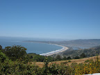
Naturally the beach was packed and there was a backup of cars for at least a mile in both directions. The drivers (or temporary parkers) were quite chatty, asking me questions as I rode by or cheering me on. Friendly, silly people, thinking that they will find parking at the beach at 1pm on July 4th.
At Stinson Beach, the route meets up with Highway 1 going south. This stretch offered some spectacular views of the coast, a prelude, I'm sure, to our upcoming ride down Highway 1 in August.
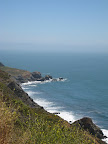
The last stretch of the loop takes you along Muir Woods Road, to the Muir Woods Park area, then up, up, up again to intersect Panoramic Highway and head back to Sausalito.
According to my Topo! map, the route has a total elevation gain of 6200 feet. Now I think that the Topo software ends up tacking on extra feet depending on how you draw the map, so the total climbing is probably more in the neighbordhood of 4500-5500 feet. Although this is more climbing than I normally enjoy, it was really a spectacular route.
Update 7/15: I ended up plotting this route on Bikely.com and I came up with total elevation gain of about 5200 feet.
Distance: 42 miles
Time in the Saddle: 5 hours
Altnerate title: Yes, you are riding halfway up Mount Tam, stupid.
I started at the Ferry building in San Francisco and rode the standard route over the Golden Gate bridge and into Sausalito. In Mill Valley, the route takes you up through some really beautiful wooded neighborhoods and then drops you onto Panoramic Highway. This highway is indeed very pictureseque and offers some lovely panoramas, but it's unevenly graded with some pretty steep sections. At the ranger station at 1500 feet, I realized that I was basically about half way up to Mount Tamalpais; at the station I could have taken a right to continue another 1000-1500 feet to the summit. But I didn't. I continued on Panoramic highway, which descends right down to Stinson Beach.
Naturally the beach was packed and there was a backup of cars for at least a mile in both directions. The drivers (or temporary parkers) were quite chatty, asking me questions as I rode by or cheering me on. Friendly, silly people, thinking that they will find parking at the beach at 1pm on July 4th.
At Stinson Beach, the route meets up with Highway 1 going south. This stretch offered some spectacular views of the coast, a prelude, I'm sure, to our upcoming ride down Highway 1 in August.
The last stretch of the loop takes you along Muir Woods Road, to the Muir Woods Park area, then up, up, up again to intersect Panoramic Highway and head back to Sausalito.
According to my Topo! map, the route has a total elevation gain of 6200 feet. Now I think that the Topo software ends up tacking on extra feet depending on how you draw the map, so the total climbing is probably more in the neighbordhood of 4500-5500 feet. Although this is more climbing than I normally enjoy, it was really a spectacular route.
Update 7/15: I ended up plotting this route on Bikely.com and I came up with total elevation gain of about 5200 feet.
Distance: 42 miles
Time in the Saddle: 5 hours
Sunday, July 1, 2007
June mileage stats
Somehow I managed to log over 400 miles again last month.. the fourth month in a row where I've reached that milestone. Year-to-date total thus far is 2223 miles.
June mileage: 405
June Time in the Saddle: 35.7 hours
June mileage: 405
June Time in the Saddle: 35.7 hours
Saturday, June 30, 2007
Giro di Peninsula (metric)
This morning I woke up at 5:45(!) to drive over to San Mateo for the Giro di Peninsula ride. I only did the metric century, which was plenty for me, with about 3000 feet of climbing overall. The principal climb was up Page Mill Road in Palo Alto. This is a popular climb on the peninsula, but it's very inconsistently graded with some steep portions. And although that's the only major climb I remember, I had the distinct feeling of going just slightly up hill for the majority of the ride. At the finish, the guy handing out t-shirts asked me how the ride was, and I said, "hilly". He gave me this look like, Duh.
I have a theory that I'm working on that roads on the peninsula are more inconsistently graded than the roads in the east bay. I have to do some research on that.
Anyway, the ride was well-supported, with an abundance of rest stops. There were FIVE rest stops for the metric route, which is a bit of an overkill in my opinion. I skipped the last one and probably could have skipped the first as well. I will say that the rest stops had delicious home made cookies, but not enough toilets. One rider at the third stop noted that the number of porta-potties were decreasing with each stop: first three, then two, then one. Strange to have so many rest stops but so few toilets.
Then at the end (at Bay Meadows Racetrack), the organizers hosted a real nice hot lunch, with different pastas, meat balls, sausage, lots of good stuff. Did I mention there was an Italian theme? Naturally, for the occasion I road my Dolce.
Animules: one deer standing in the middle of Crystal Springs Road; lots of horses
Distance: 62 miles
Time in the Saddle: 5 hours, 10 minutes
Subscribe to:
Posts (Atom)
