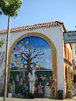
 On this pass through Fairfax, I skipped the weird coffee shop with the bad live music, although as I was cruising by, I caught this guy working on a mural on the side of the building. He was making quick work of it too, with Pink Floyd or something similar blaring from his stereo.
The approach past Alpine Lake Dam and on up to Ridgecrest Road felt a little easier this time, but I still struggled mightily on Ridgecrest. This stretch is only about 4 miles and only gains about 600 feet, but it’s all steep rollers, which are my least favorite type of hill. I was huffing and puffing along when a couple of guys passed me, one saying to me, “Do your friends know you’re out here climbing mountains? They must think you’re crazy!”. Heh. Yeah, kinda. I told them I was training for the Death Ride, and it turns out he’s done it like 5 years in a row. He said one year he even did the ride with his wife on a tandem. Took them all day. You know, I have a certain mental image of the kind of ride where a tandem would be fun, and the Death Ride ain’t it. At any rate, I ran my 3 pass plan by him (Monitor, 2 Ebbetts) and he said it was a good plan. He also said the front side of Ebbetts will be the most challenging for me.
From Ridgecrest, the climb up to the summit wasn’t bad at all. I love that they have a snack bar up at the visitors’ center. Nothing like a cold root beer after climbing a mountain.
From the summit, I descended to the ranger station, and then faced a choice: turn left and have quick descent back to Sausalito, or turn right, descend to Stinson Beach and then climb back up. I really needed to get a bit more climbing in, so I chose the Stinson option. This route to Stinson via Panoramic Highway is really lovely, continuing through the woods and then thrusting you out onto the ridge overlooking the Pacific. It would be an awesome descent if it weren’t for the horrid state of the road and the car traffic. I was a little worried about the traffic climbing back up from Stinson, because there’s really no shoulder on this road. There were a few cars, but I guess it was early enough that people were still enjoying the beach. The climb ended up being pretty enjoyable, at about 4 miles and 1500 feet. The cool sea breeze on the ocean side was particularly refreshing. And with that extra climb in, I was able to cruise back to Sausalito feeling like I had put in a good day’s work.
Next weekend will be the final official training ride before the Adirondacks trip and the Death Ride following that. So on Saturday, my goal is to do at least 50 miles and 6500 feet of climbing.
Total Distance: 49 miles
Animules: several deer in Mill Valley
Elevation gain: about 5500 feet
Time in the Saddle: 5 hours 17 minutes
Elevation profile (from Klimb software):


No comments:
Post a Comment